Area Overview for WS7 0LH
Photos of WS7 0LH

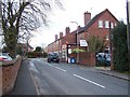
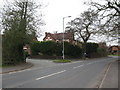
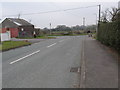
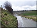

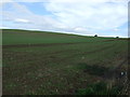


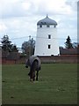
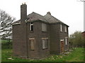
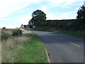
16 photos from this area
Area Information
Key information about the WS7 0LH including its size, population, and administrative classification.
- Area Type
- Postcode
- Area Size
- 6.1 hectares
- Population
- 1582
- Population Density
- 183 people/km²
House Prices in WS7 0LH
30
Properties
£250,569
Average Sold Price
£20,665
Lowest Price
£547,500
Highest Price
Showing 30 properties
| Address | Type | Beds | Baths | Last Sale Price | Last Sale Date | |
|---|---|---|---|---|---|---|
| 142 Overton Lane, Hammerwich, Burntwood, WS7 0LH | house | - | - | £505,000 | Feb 2024 | |
| 22 Overton Lane, Hammerwich, Burntwood, WS7 0LH | Semi-detached | 3 | 1 | £237,000 | Aug 2022 | |
| 158 Overton Lane, Hammerwich, Burntwood, WS7 0LH | house | - | - | £547,500 | Mar 2021 | |
| 148 Overton Lane, Hammerwich, Burntwood, WS7 0LH | house | - | - | £452,500 | May 2020 | |
| 36 Overton Lane, Hammerwich, Burntwood, WS7 0LH | house | - | - | £201,500 | Aug 2017 | |
| 12 Overton Lane, Hammerwich, Burntwood, WS7 0LH | Terraced | 3 | 1 | £157,000 | Aug 2016 | |
| 16 Overton Lane, Hammerwich, Burntwood, WS7 0LH | Terraced | 2 | - | £160,000 | Jan 2016 | |
| 34 Overton Lane, Hammerwich, Burntwood, WS7 0LH | Semi-detached | 3 | - | £189,950 | Nov 2014 | |
| 32 Overton Lane, Hammerwich, Burntwood, WS7 0LH | house | 3 | - | £175,000 | Aug 2010 | |
| 30 Overton Lane, Hammerwich, Burntwood, WS7 0LH | Semi-detached | - | - | £174,995 | Nov 2008 |
Page 1 of 3
Energy Efficiency in WS7 0LH
Amenities
Schools
| Rank | School | Type | Entry gender | Ages |
|---|
Explore more schools in this area
Go to Schools tabDemographics
Household Size
Two person
most common
Accommodation Type
Houses
most common
Tenure
83
majority
Ethnic Group
White
most common
Religion
N/A
most common
Household Composition
N/A
most common
Age
47
median
Adults (30-64 years)
most common
Household Deprivation
N/A
with no deprivation
NS-SEC
40
in Lower managerial occupations
Explore more demographic insights in this area
Go to Demographics tabPlanning
Planning Constraints
- Flood RiskPremium
- Ramsar Wetland SitesPremium
- Area of Outstanding Natural BeautyPremium
- Protected Nature ReservePremium
- Protected WoodlandPremium