Area Overview for WS2 8UB
Photos of WS2 8UB
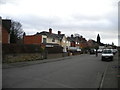
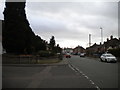
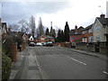
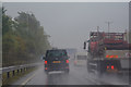
39 photos from this area
Area Information
Key information about the WS2 8UB including its size, population, and administrative classification.
- Area Type
- Postcode
- Area Size
- 8826 m²
- Population
- 1757
- Population Density
- 3511 people/km²
House Prices in WS2 8UB
26
Properties
£94,871
Average Sold Price
£47,950
Lowest Price
£244,000
Highest Price
Showing 26 properties
| Address | Type | Beds | Baths | Last Sale Price | Last Sale Date | |
|---|---|---|---|---|---|---|
| 16 Westville Road, Walsall, WS2 8UB | Semi-detached | 4 | 2 | £244,000 | Nov 2023 | |
| 5 Westville Road, Walsall, WS2 8UB | house | - | - | £158,000 | Mar 2021 | |
| 1 Westville Road, Walsall, WS2 8UB | house | - | - | £106,000 | Nov 2014 | |
| 26 Westville Road, Walsall, WS2 8UB | house | - | - | £143,500 | Jul 2010 | |
| 6 Westville Road, Walsall, WS2 8UB | Semi-detached | - | - | £100,000 | Mar 2004 | |
| 10 Westville Road, Walsall, WS2 8UB | house | - | - | £79,000 | Apr 2003 | |
| 8 Westville Road, Walsall, WS2 8UB | Semi-detached | - | - | £47,950 | Apr 2001 | |
| 13 Westville Road, Walsall, WS2 8UB | Semi-detached | - | - | £55,000 | Jun 2000 | |
| 22 Westville Road, Walsall, WS2 8UB | Semi-detached | - | - | £50,000 | Oct 1997 | |
| 14 Westville Road, Walsall, WS2 8UB | Semi-detached | - | - | £49,000 | Aug 1997 |
Page 1 of 3
Energy Efficiency in WS2 8UB
Amenities
Schools
| Rank | School | Type | Entry gender | Ages |
|---|
Explore more schools in this area
Go to Schools tabDemographics
Household Size
Family (3-5 people)
most common
Accommodation Type
Houses
most common
Tenure
55
majority
Ethnic Group
White
most common
Religion
N/A
most common
Household Composition
N/A
most common
Age
47
median
Adults (30-64 years)
most common
Household Deprivation
N/A
with no deprivation
NS-SEC
18
in Lower managerial occupations
Explore more demographic insights in this area
Go to Demographics tabPlanning
Planning Constraints
- Flood RiskPremium
- Ramsar Wetland SitesPremium
- Area of Outstanding Natural BeautyPremium
- Protected Nature ReservePremium
- Protected WoodlandPremium