Area Overview for WS2 8UA
Photos of WS2 8UA
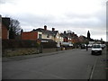
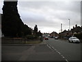
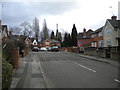


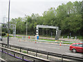
39 photos from this area
Area Information
Key information about the WS2 8UA including its size, population, and administrative classification.
- Area Type
- Postcode
- Area Size
- 7347 m²
- Population
- 1757
- Population Density
- 3511 people/km²
House Prices in WS2 8UA
20
Properties
£94,746
Average Sold Price
£40,000
Lowest Price
£220,000
Highest Price
Showing 20 properties
| Address | Type | Beds | Baths | Last Sale Price | Last Sale Date | |
|---|---|---|---|---|---|---|
| 21 Naunton Road, Walsall, WS2 8UA | house | 3 | - | £181,000 | Dec 2020 | |
| 25 Naunton Road, Walsall, WS2 8UA | Semi-detached | 5 | 2 | £220,000 | Dec 2017 | |
| 10 Naunton Road, Walsall, WS2 8UA | Semi-detached | 3 | 1 | £111,000 | Nov 2013 | |
| 19 Naunton Road, Walsall, WS2 8UA | house | - | - | £151,000 | Jun 2011 | |
| 23 Naunton Road, Walsall, WS2 8UA | house | - | - | £40,000 | Feb 2004 | |
| 7 Naunton Road, Walsall, WS2 8UA | house | - | - | £108,500 | Dec 2003 | |
| 16 Naunton Road, Walsall, WS2 8UA | Semi-detached | - | - | £56,000 | Feb 2002 | |
| 5 Naunton Road, Walsall, WS2 8UA | Semi-detached | - | - | £57,000 | Jun 2001 | |
| 13 Naunton Road, Walsall, WS2 8UA | Semi-detached | 3 | 2 | £59,500 | Feb 2000 | |
| 17 Naunton Road, Walsall, WS2 8UA | Semi-detached | - | - | £51,000 | May 1997 |
Page 1 of 2
Energy Efficiency in WS2 8UA
Amenities
Schools
| Rank | School | Type | Entry gender | Ages |
|---|
Explore more schools in this area
Go to Schools tabDemographics
Household Size
Family (3-5 people)
most common
Accommodation Type
Houses
most common
Tenure
55
majority
Ethnic Group
White
most common
Religion
N/A
most common
Household Composition
N/A
most common
Age
47
median
Adults (30-64 years)
most common
Household Deprivation
N/A
with no deprivation
NS-SEC
18
in Lower managerial occupations
Explore more demographic insights in this area
Go to Demographics tabPlanning
Planning Constraints
- Flood RiskPremium
- Ramsar Wetland SitesPremium
- Area of Outstanding Natural BeautyPremium
- Protected Nature ReservePremium
- Protected WoodlandPremium