Area Overview for WS15 4TB
Photos of WS15 4TB
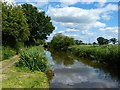
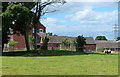
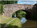
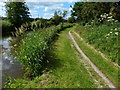
54 photos from this area
Area Information
Key information about the WS15 4TB including its size, population, and administrative classification.
- Area Type
- Postcode
- Area Size
- 1.1 hectares
- Population
- 1575
- Population Density
- 1481 people/km²
House Prices in WS15 4TB
20
Properties
£192,672
Average Sold Price
£82,250
Lowest Price
£380,000
Highest Price
Showing 20 properties
| Address | Type | Beds | Baths | Last Sale Price | Last Sale Date | |
|---|---|---|---|---|---|---|
| 8 Warren Croft, Handsacre, Rugeley, WS15 4TB | house | 4 | 2 | £356,000 | Aug 2024 | |
| 2 Warren Croft, Handsacre, Rugeley, WS15 4TB | Detached | 4 | 2 | £380,000 | Aug 2023 | |
| 23 Warren Croft, Handsacre, Rugeley, WS15 4TB | Detached | 4 | 2 | £267,000 | Aug 2018 | |
| 13 Warren Croft, Handsacre, Rugeley, WS15 4TB | house | - | - | £217,000 | Nov 2015 | |
| 12 Warren Croft, Handsacre, Rugeley, WS15 4TB | Detached | - | - | £225,000 | Jun 2012 | |
| 15 Warren Croft, Handsacre, Rugeley, WS15 4TB | house | 3 | - | £192,000 | Apr 2011 | |
| 1 Warren Croft, Handsacre, Rugeley, WS15 4TB | Detached | - | - | £247,000 | May 2008 | |
| 21 Warren Croft, Handsacre, Rugeley, WS15 4TB | Detached | - | - | £200,000 | Jan 2007 | |
| 10 Warren Croft, Handsacre, Rugeley, WS15 4TB | Detached | 4 | - | £198,500 | May 2004 | |
| 4 Warren Croft, Handsacre, Rugeley, WS15 4TB | Detached | - | - | £182,000 | Mar 2004 |
Page 1 of 2
Energy Efficiency in WS15 4TB
Amenities
Schools
| Rank | School | Type | Entry gender | Ages |
|---|
Explore more schools in this area
Go to Schools tabDemographics
Household Size
Two person
most common
Accommodation Type
Houses
most common
Tenure
72
majority
Ethnic Group
White
most common
Religion
N/A
most common
Household Composition
N/A
most common
Age
47
median
Adults (30-64 years)
most common
Household Deprivation
N/A
with no deprivation
NS-SEC
28
in Lower managerial occupations
Explore more demographic insights in this area
Go to Demographics tabPlanning
Planning Constraints
- Flood RiskPremium
- Ramsar Wetland SitesPremium
- Area of Outstanding Natural BeautyPremium
- Protected Nature ReservePremium
- Protected WoodlandPremium