Area Overview for WS15 3DL
Photos of WS15 3DL
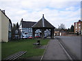
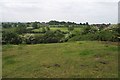
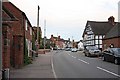
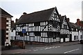
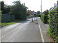
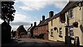
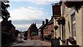
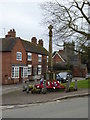
56 photos from this area
Area Information
Key information about the WS15 3DL including its size, population, and administrative classification.
- Area Type
- Postcode
- Area Size
- 8.3 hectares
- Population
- 1333
- Population Density
- 461 people/km²
House Prices in WS15 3DL
27
Properties
£325,721
Average Sold Price
£49,200
Lowest Price
£663,000
Highest Price
Showing 27 properties
| Address | Type | Beds | Baths | Last Sale Price | Last Sale Date | |
|---|---|---|---|---|---|---|
| Stoneleigh, Lichfield Road, Abbots Bromley, WS15 3DL | Detached | 4 | 3 | £585,000 | Oct 2022 | |
| Bank House, Lichfield Road, Abbots Bromley, WS15 3DL | Detached | - | - | £320,000 | Feb 2021 | |
| 1, Holly Bank, Lichfield Road, Abbots Bromley, WS15 3DL | house | - | - | £223,500 | Nov 2020 | |
| Butterton House, Lichfield Road, Abbots Bromley, WS15 3DL | Detached | 4 | 2 | £663,000 | Nov 2020 | |
| Beck House, Lichfield Road, Abbots Bromley, WS15 3DL | Detached | - | - | £383,000 | Nov 2016 | |
| Town End Farm House, Lichfield Road, Abbots Bromley, WS15 3DL | Detached | 4 | 2 | £440,000 | Aug 2016 | |
| 2, Holly Bank, Lichfield Road, Abbots Bromley, WS15 3DL | Terraced | 1 | - | £109,226 | Feb 2014 | |
| Mayfield House, Lichfield Road, Abbots Bromley, WS15 3DL | Detached | - | - | £465,000 | Jul 2004 | |
| 4 Lichfield Road, Abbots Bromley, WS15 3DL | house | - | - | £135,000 | Jun 2004 | |
| Field House, Lichfield Road, Abbots Bromley, WS15 3DL | house | 5 | 3 | £210,000 | Jul 2002 |
Page 1 of 3
Energy Efficiency in WS15 3DL
Amenities
Schools
| Rank | School | Type | Entry gender | Ages |
|---|
Explore more schools in this area
Go to Schools tabDemographics
Household Size
Two person
most common
Accommodation Type
Houses
most common
Tenure
80
majority
Ethnic Group
White
most common
Religion
N/A
most common
Household Composition
N/A
most common
Age
47
median
Adults (30-64 years)
most common
Household Deprivation
N/A
with no deprivation
NS-SEC
45
in Lower managerial occupations
Explore more demographic insights in this area
Go to Demographics tabPlanning
Planning Constraints
- Flood RiskPremium
- Ramsar Wetland SitesPremium
- Area of Outstanding Natural BeautyPremium
- Protected Nature ReservePremium
- Protected WoodlandPremium