Area Overview for WS11 9QR
Photos of WS11 9QR

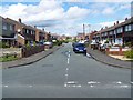

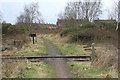
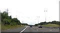
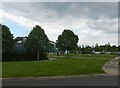
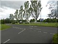

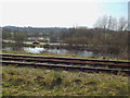
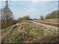
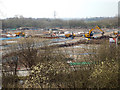
57 photos from this area
Area Information
Key information about the WS11 9QR including its size, population, and administrative classification.
- Area Type
- Postcode
- Area Size
- 1.1 hectares
- Population
- 2632
- Population Density
- 5153 people/km²
House Prices in WS11 9QR
31
Properties
£123,229
Average Sold Price
£6,000
Lowest Price
£225,000
Highest Price
Showing 31 properties
| Address | Type | Beds | Baths | Last Sale Price | Last Sale Date | |
|---|---|---|---|---|---|---|
| 16 Red Lion Avenue, Norton Canes, Cannock, WS11 9QR | Semi-detached | 3 | 1 | £185,000 | Nov 2023 | |
| 3 Red Lion Avenue, Norton Canes, Cannock, WS11 9QR | house | 3 | 1 | £190,000 | Jun 2022 | |
| 23 Red Lion Avenue, Norton Canes, Cannock, WS11 9QR | Semi-detached | 3 | 1 | £225,000 | Feb 2022 | |
| 26 Red Lion Avenue, Norton Canes, Cannock, WS11 9QR | house | 3 | 1 | £171,000 | Feb 2022 | |
| 17 Red Lion Avenue, Norton Canes, Cannock, WS11 9QR | Semi-detached | - | - | £6,000 | Jun 2016 | |
| 28 Red Lion Avenue, Norton Canes, Cannock, WS11 9QR | house | - | - | £105,000 | Apr 2016 | |
| 30 Red Lion Avenue, Norton Canes, Cannock, WS11 9QR | Terraced | 3 | 1 | £100,000 | Mar 2016 | |
| 14 Red Lion Avenue, Norton Canes, Cannock, WS11 9QR | house | 3 | 1 | £118,000 | Dec 2015 | |
| 19 Red Lion Avenue, Norton Canes, Cannock, WS11 9QR | Detached | 3 | 2 | £123,000 | Apr 2015 | |
| 27 Red Lion Avenue, Norton Canes, Cannock, WS11 9QR | Semi-detached | 3 | 2 | £144,000 | Sep 2014 |
Page 1 of 4
Energy Efficiency in WS11 9QR
Amenities
Schools
| Rank | School | Type | Entry gender | Ages |
|---|
Explore more schools in this area
Go to Schools tabDemographics
Household Size
Family (3-5 people)
most common
Accommodation Type
Houses
most common
Tenure
58
majority
Ethnic Group
White
most common
Religion
N/A
most common
Household Composition
N/A
most common
Age
47
median
Adults (30-64 years)
most common
Household Deprivation
N/A
with no deprivation
NS-SEC
25
in Lower managerial occupations
Explore more demographic insights in this area
Go to Demographics tabPlanning
Planning Constraints
- Flood RiskPremium
- Ramsar Wetland SitesPremium
- Area of Outstanding Natural BeautyPremium
- Protected Nature ReservePremium
- Protected WoodlandPremium