Area Overview for WS10 8LP
Photos of WS10 8LP

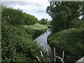
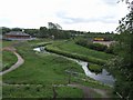
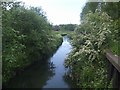
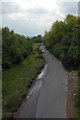
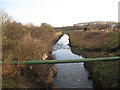


66 photos from this area
Area Information
Key information about the WS10 8LP including its size, population, and administrative classification.
- Area Type
- Postcode
- Area Size
- 16.3 hectares
- Population
- 2033
- Population Density
- 2237 people/km²
House Prices in WS10 8LP
11
Properties
£140,000
Average Sold Price
£140,000
Lowest Price
£140,000
Highest Price
Showing 11 properties
| Address | Type | Beds | Baths | Last Sale Price | Last Sale Date | |
|---|---|---|---|---|---|---|
| 56 HEATH ROAD, Darlaston, WS10 8LP | Semi-detached | - | - | £140,000 | Nov 2016 | |
| 55 Heath Road, Darlaston, WS10 8LP | Industrial | - | - | - | - | |
| Derelict Unit, Imperial Works, Heath Road, Darlaston, WS10 8LP | office_workshop | - | - | - | - | |
| Scrap Car Buyers, Heath Road, Darlaston, WS10 8LP | Industrial | - | - | - | - | |
| Bhandal Business Park, Heath Road, Darlaston, WS10 8LP | warehouse | - | - | - | - | |
| Unit 26, Bhandal Business Park, Heath Road, Darlaston, WS10 8LP | Industrial | - | - | - | - | |
| Unit 22, Bhandal Business Park, Heath Road, Darlaston, WS10 8LP | Office | - | - | - | - | |
| Lucky Charm Car Finance, Unit 25, Bhandal Business Park, Heath Road, Darlaston, WS10 8LP | Office | - | - | - | - | |
| Unit 23, Bhandal Business Park, Heath Road, Darlaston, WS10 8LP | Office | - | - | - | - | |
| George Dyke Ltd, Heath Road, Darlaston, WS10 8LP | general_industrial | - | - | - | - |
Page 1 of 2
Energy Efficiency in WS10 8LP
Amenities
Schools
| Rank | School | Type | Entry gender | Ages |
|---|
Explore more schools in this area
Go to Schools tabDemographics
Household Size
Family (3-5 people)
most common
Accommodation Type
Houses
most common
Tenure
37
majority
Ethnic Group
asian_total
most common
Religion
N/A
most common
Household Composition
N/A
most common
Age
47
median
Adults (30-64 years)
most common
Household Deprivation
N/A
with no deprivation
NS-SEC
13
in Lower managerial occupations
Explore more demographic insights in this area
Go to Demographics tabPlanning
Planning Constraints
- Flood RiskPremium
- Ramsar Wetland SitesPremium
- Area of Outstanding Natural BeautyPremium
- Protected Nature ReservePremium
- Protected WoodlandPremium