Area Overview for WR9 7PA
Photos of WR9 7PA
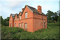


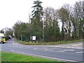


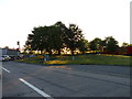

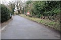

35 photos from this area
Area Information
Key information about the WR9 7PA including its size, population, and administrative classification.
- Area Type
- Postcode
- Area Size
- 3.2 hectares
- Population
- 1606
- Population Density
- 77 people/km²
House Prices in WR9 7PA
35
Properties
£242,037
Average Sold Price
£68,000
Lowest Price
£485,000
Highest Price
Showing 35 properties
| Address | Type | Beds | Baths | Last Sale Price | Last Sale Date | |
|---|---|---|---|---|---|---|
| Robins Retreat, Worcester Road, Wychbold, WR9 7PA | Detached | 4 | 3 | £385,000 | Jul 2025 | |
| Bacchus, Worcester Road, Wychbold, WR9 7PA | Detached | 3 | 1 | £485,000 | Mar 2025 | |
| Buckleberry, Worcester Road, Wychbold, WR9 7PA | Semi-detached | 2 | - | £185,000 | Dec 2020 | |
| Lawn Cottage, Worcester Road, Wychbold, WR9 7PA | Semi-detached | 2 | 1 | £195,000 | Nov 2019 | |
| Rose Dene, Worcester Road, Wychbold, WR9 7PA | Semi-detached | 2 | 1 | £220,000 | Aug 2018 | |
| 3, Post Office Row, Worcester Road, Wychbold, WR9 7PA | Detached | 4 | 2 | £147,500 | Jul 2018 | |
| The Nest, Worcester Road, Wychbold, WR9 7PA | Detached | 3 | 1 | £284,000 | Dec 2016 | |
| White Cottage, Worcester Road, Wychbold, WR9 7PA | Detached | 4 | 2 | £375,000 | Nov 2014 | |
| Sandlewood, Worcester Road, Wychbold, WR9 7PA | Terraced | 2 | - | £68,000 | Oct 2014 | |
| Lothlorien, Worcester Road, Wychbold, WR9 7PA | Semi-detached | 2 | 1 | £164,995 | Jul 2014 |
Page 1 of 4
Energy Efficiency in WR9 7PA
Amenities
Schools
| Rank | School | Type | Entry gender | Ages |
|---|
Explore more schools in this area
Go to Schools tabDemographics
Household Size
Family (3-5 people)
most common
Accommodation Type
Houses
most common
Tenure
76
majority
Ethnic Group
White
most common
Religion
N/A
most common
Household Composition
N/A
most common
Age
47
median
Adults (30-64 years)
most common
Household Deprivation
N/A
with no deprivation
NS-SEC
42
in Lower managerial occupations
Explore more demographic insights in this area
Go to Demographics tabPlanning
Planning Constraints
- Flood RiskPremium
- Ramsar Wetland SitesPremium
- Area of Outstanding Natural BeautyPremium
- Protected Nature ReservePremium
- Protected WoodlandPremium