Area Overview for WR5 1RF
Photos of WR5 1RF

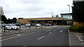

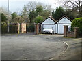
80 photos from this area
Area Information
Key information about the WR5 1RF including its size, population, and administrative classification.
- Area Type
- Postcode
- Area Size
- 2.6 hectares
- Population
- 1734
- Population Density
- 1522 people/km²
House Prices in WR5 1RF
39
Properties
£261,088
Average Sold Price
£58,000
Lowest Price
£525,000
Highest Price
Showing 39 properties
| Address | Type | Beds | Baths | Last Sale Price | Last Sale Date | |
|---|---|---|---|---|---|---|
| 60 Hillery Road, Worcester, WR5 1RF | Detached | 3 | 2 | £405,000 | Dec 2024 | |
| 48 Hillery Road, Worcester, WR5 1RF | house | 4 | 1 | £525,000 | Jan 2023 | |
| 67 Hillery Road, Worcester, WR5 1RF | Detached | - | - | £412,500 | Sep 2021 | |
| 65 Hillery Road, Worcester, WR5 1RF | Detached | 3 | 2 | £435,000 | Mar 2021 | |
| 58 Hillery Road, Worcester, WR5 1RF | house | - | - | £500,000 | Feb 2021 | |
| 56 Hillery Road, Worcester, WR5 1RF | house | 3 | - | £340,000 | Sep 2018 | |
| 57 Hillery Road, Worcester, WR5 1RF | Detached | 5 | 2 | £329,700 | Dec 2017 | |
| 53 Hillery Road, Worcester, WR5 1RF | Detached | - | - | £390,000 | Dec 2016 | |
| 61 Hillery Road, Worcester, WR5 1RF | Detached | 3 | 2 | £280,000 | Jun 2016 | |
| 71 Hillery Road, Worcester, WR5 1RF | Detached | - | - | £320,000 | May 2016 |
Page 1 of 4
Energy Efficiency in WR5 1RF
Amenities
Schools
| Rank | School | Type | Entry gender | Ages |
|---|
Explore more schools in this area
Go to Schools tabDemographics
Household Size
Family (3-5 people)
most common
Accommodation Type
Houses
most common
Tenure
66
majority
Ethnic Group
White
most common
Religion
N/A
most common
Household Composition
N/A
most common
Age
47
median
Adults (30-64 years)
most common
Household Deprivation
N/A
with no deprivation
NS-SEC
31
in Lower managerial occupations
Explore more demographic insights in this area
Go to Demographics tabPlanning
Planning Constraints
- Flood RiskPremium
- Ramsar Wetland SitesPremium
- Area of Outstanding Natural BeautyPremium
- Protected Nature ReservePremium
- Protected WoodlandPremium