Area Overview for WR5 1QB
Photos of WR5 1QB
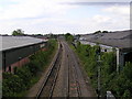
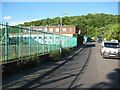
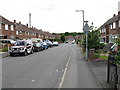
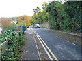
100 photos from this area
Area Information
Key information about the WR5 1QB including its size, population, and administrative classification.
- Area Type
- Postcode
- Area Size
- 1.5 hectares
- Population
- 1734
- Population Density
- 1522 people/km²
House Prices in WR5 1QB
22
Properties
£260,730
Average Sold Price
£64,000
Lowest Price
£525,000
Highest Price
Showing 22 properties
| Address | Type | Beds | Baths | Last Sale Price | Last Sale Date | |
|---|---|---|---|---|---|---|
| 50 Mortlake Avenue, Worcester, WR5 1QB | Detached | 5 | 1 | £525,000 | Dec 2025 | |
| 31 Mortlake Avenue, Worcester, WR5 1QB | Semi-detached | 3 | 1 | £278,500 | Dec 2024 | |
| 44 Mortlake Avenue, Worcester, WR5 1QB | Semi-detached | 3 | 2 | £405,000 | Sep 2023 | |
| 52 Mortlake Avenue, Worcester, WR5 1QB | Detached | 3 | 1 | £435,000 | Jul 2023 | |
| 46 Mortlake Avenue, Worcester, WR5 1QB | house | - | - | £340,000 | Mar 2021 | |
| 37 Mortlake Avenue, Worcester, WR5 1QB | house | - | - | £412,500 | Mar 2021 | |
| 41 Mortlake Avenue, Worcester, WR5 1QB | house | - | - | £230,000 | Jul 2019 | |
| 54 Mortlake Avenue, Worcester, WR5 1QB | Detached | 3 | 1 | £300,000 | Jun 2017 | |
| 33 Mortlake Avenue, Worcester, WR5 1QB | Semi-detached | 3 | 1 | £190,000 | Jul 2014 | |
| 39 Mortlake Avenue, Worcester, WR5 1QB | Semi-detached | - | - | £165,000 | Sep 2011 |
Page 1 of 3
Energy Efficiency in WR5 1QB
Amenities
Schools
| Rank | School | Type | Entry gender | Ages |
|---|
Explore more schools in this area
Go to Schools tabDemographics
Household Size
Family (3-5 people)
most common
Accommodation Type
Houses
most common
Tenure
66
majority
Ethnic Group
White
most common
Religion
N/A
most common
Household Composition
N/A
most common
Age
47
median
Adults (30-64 years)
most common
Household Deprivation
N/A
with no deprivation
NS-SEC
31
in Lower managerial occupations
Explore more demographic insights in this area
Go to Demographics tabPlanning
Planning Constraints
- Flood RiskPremium
- Ramsar Wetland SitesPremium
- Area of Outstanding Natural BeautyPremium
- Protected Nature ReservePremium
- Protected WoodlandPremium