Area Overview for WR3 7JY
Photos of WR3 7JY
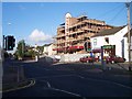
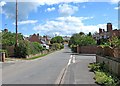

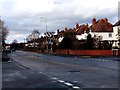
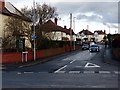
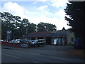
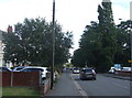


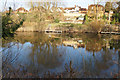
59 photos from this area
Area Information
Key information about the WR3 7JY including its size, population, and administrative classification.
- Area Type
- Postcode
- Area Size
- 2.3 hectares
- Population
- 1553
- Population Density
- 4584 people/km²
House Prices in WR3 7JY
22
Properties
£166,909
Average Sold Price
£57,000
Lowest Price
£260,000
Highest Price
Showing 22 properties
| Address | Type | Beds | Baths | Last Sale Price | Last Sale Date | |
|---|---|---|---|---|---|---|
| 157 Droitwich Road, Worcester, WR3 7JY | Semi-detached | 3 | - | £260,000 | Feb 2023 | |
| 131 Droitwich Road, Worcester, WR3 7JY | house | - | - | £225,000 | Apr 2021 | |
| 137 Droitwich Road, Worcester, WR3 7JY | house | - | - | £188,000 | Aug 2018 | |
| 173 Droitwich Road, Worcester, WR3 7JY | Semi-detached | 3 | 2 | £180,000 | Nov 2017 | |
| 169 Droitwich Road, Worcester, WR3 7JY | house | - | - | £221,000 | Jun 2016 | |
| 155 Droitwich Road, Worcester, WR3 7JY | Semi-detached | 3 | - | £187,000 | Sep 2015 | |
| 159 Droitwich Road, Worcester, WR3 7JY | Semi-detached | 3 | - | £171,000 | Mar 2012 | |
| 171 Droitwich Road, Worcester, WR3 7JY | house | - | - | £152,500 | Feb 2011 | |
| 149 Droitwich Road, Worcester, WR3 7JY | Semi-detached | 3 | 1 | £137,000 | Apr 2004 | |
| 139 Droitwich Road, Worcester, WR3 7JY | Semi-detached | - | - | £57,000 | Nov 1998 |
Page 1 of 3
Energy Efficiency in WR3 7JY
Amenities
Schools
| Rank | School | Type | Entry gender | Ages |
|---|
Explore more schools in this area
Go to Schools tabDemographics
Household Size
Two person
most common
Accommodation Type
Houses
most common
Tenure
74
majority
Ethnic Group
White
most common
Religion
N/A
most common
Household Composition
N/A
most common
Age
47
median
Adults (30-64 years)
most common
Household Deprivation
N/A
with no deprivation
NS-SEC
42
in Lower managerial occupations
Explore more demographic insights in this area
Go to Demographics tabPlanning
Planning Constraints
- Flood RiskPremium
- Ramsar Wetland SitesPremium
- Area of Outstanding Natural BeautyPremium
- Protected Nature ReservePremium
- Protected WoodlandPremium