Area Overview for WR3 7JL
Photos of WR3 7JL
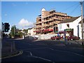
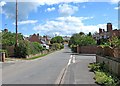

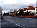
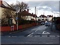
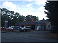
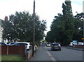


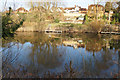
59 photos from this area
Area Information
Key information about the WR3 7JL including its size, population, and administrative classification.
- Area Type
- Postcode
- Area Size
- 1.0 hectares
- Population
- 1553
- Population Density
- 4584 people/km²
House Prices in WR3 7JL
23
Properties
£172,621
Average Sold Price
£56,950
Lowest Price
£280,000
Highest Price
Showing 23 properties
| Address | Type | Beds | Baths | Last Sale Price | Last Sale Date | |
|---|---|---|---|---|---|---|
| 13 Cope Road, Worcester, WR3 7JL | Semi-detached | 3 | 1 | £270,500 | Sep 2024 | |
| 14 Cope Road, Worcester, WR3 7JL | Semi-detached | 3 | 2 | £280,000 | Jun 2024 | |
| 22 Cope Road, Worcester, WR3 7JL | Semi-detached | 3 | 1 | £275,000 | Mar 2024 | |
| 9 Cope Road, Worcester, WR3 7JL | house | 3 | - | £237,000 | Mar 2021 | |
| 20 Cope Road, Worcester, WR3 7JL | Semi-detached | 3 | - | £210,000 | Apr 2016 | |
| 21 Cope Road, Worcester, WR3 7JL | Semi-detached | 3 | - | £150,000 | Feb 2013 | |
| 23 Cope Road, Worcester, WR3 7JL | house | - | - | £140,000 | Feb 2013 | |
| 16 Cope Road, Worcester, WR3 7JL | house | - | - | £138,500 | Jul 2009 | |
| 12 Cope Road, Worcester, WR3 7JL | Semi-detached | - | - | £147,500 | Nov 2006 | |
| 17 Cope Road, Worcester, WR3 7JL | house | - | - | £107,000 | Jun 2002 |
Page 1 of 3
Energy Efficiency in WR3 7JL
Amenities
Schools
| Rank | School | Type | Entry gender | Ages |
|---|
Explore more schools in this area
Go to Schools tabDemographics
Household Size
Two person
most common
Accommodation Type
Houses
most common
Tenure
74
majority
Ethnic Group
White
most common
Religion
N/A
most common
Household Composition
N/A
most common
Age
47
median
Adults (30-64 years)
most common
Household Deprivation
N/A
with no deprivation
NS-SEC
42
in Lower managerial occupations
Explore more demographic insights in this area
Go to Demographics tabPlanning
Planning Constraints
- Flood RiskPremium
- Ramsar Wetland SitesPremium
- Area of Outstanding Natural BeautyPremium
- Protected Nature ReservePremium
- Protected WoodlandPremium