Area Overview for WR11 8HX
Photos of WR11 8HX
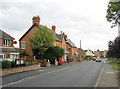
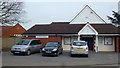
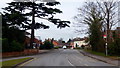
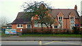
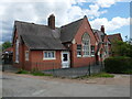
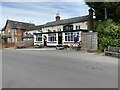
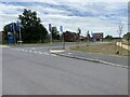
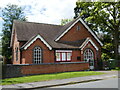
27 photos from this area
Area Information
Key information about the WR11 8HX including its size, population, and administrative classification.
- Area Type
- Postcode
- Area Size
- 9276 m²
- Population
- 1381
- Population Density
- 366 people/km²
House Prices in WR11 8HX
12
Properties
£311,600
Average Sold Price
£98,000
Lowest Price
£500,000
Highest Price
Showing 12 properties
| Address | Type | Beds | Baths | Last Sale Price | Last Sale Date | |
|---|---|---|---|---|---|---|
| Seaton, Alcester Road, Harvington, WR11 8HX | Bungalow | 3 | 1 | £500,000 | May 2025 | |
| Teasel Cottage, Alcester Road, Harvington, WR11 8HX | Bungalow | 3 | 2 | £500,000 | Feb 2022 | |
| 1, Rose Villas, Alcester Road, Harvington, WR11 8HX | Semi-detached | 2 | 1 | £180,000 | Jul 2020 | |
| Greengates, Alcester Road, Harvington, WR11 8HX | house | 3 | 1 | £280,000 | Nov 2017 | |
| 2, Rose Villas, Evesham Road, Harvington, WR11 8HX | Semi-detached | 2 | - | £98,000 | Sep 2002 | |
| Beaumont House, Evesham Road, Harvington, WR11 8HX | undefined | - | - | - | - | |
| Santers, Evesham Road, Harvington, WR11 8HX | undefined | - | - | - | - | |
| Four Chevrons, Alcester Road, Harvington, WR11 8HX | Terraced | - | - | - | - | |
| Holmleigh, Alcester Road, Harvington, WR11 8HX | Detached | - | - | - | - | |
| 2, Westholme House, Alcester Road, Harvington, WR11 8HX | Flat | - | - | - | - |
Page 1 of 2
Energy Efficiency in WR11 8HX
Amenities
Schools
| Rank | School | Type | Entry gender | Ages |
|---|
Explore more schools in this area
Go to Schools tabDemographics
Household Size
Two person
most common
Accommodation Type
Houses
most common
Tenure
83
majority
Ethnic Group
White
most common
Religion
N/A
most common
Household Composition
N/A
most common
Age
47
median
Adults (30-64 years)
most common
Household Deprivation
N/A
with no deprivation
NS-SEC
41
in Lower managerial occupations
Explore more demographic insights in this area
Go to Demographics tabPlanning
Planning Constraints
- Flood RiskPremium
- Ramsar Wetland SitesPremium
- Area of Outstanding Natural BeautyPremium
- Protected Nature ReservePremium
- Protected WoodlandPremium