Area Overview for WR11 8NQ
Photos of WR11 8NQ
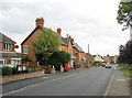

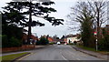

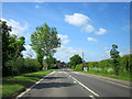
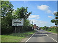
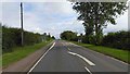
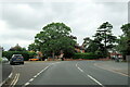
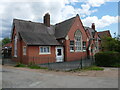
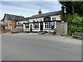

27 photos from this area
Area Information
Key information about the WR11 8NQ including its size, population, and administrative classification.
- Area Type
- Postcode
- Area Size
- 12.4 hectares
- Population
- 1381
- Population Density
- 366 people/km²
House Prices in WR11 8NQ
76
Properties
£324,258
Average Sold Price
£69,750
Lowest Price
£948,800
Highest Price
Showing 76 properties
| Address | Type | Beds | Baths | Last Sale Price | Last Sale Date | |
|---|---|---|---|---|---|---|
| 79 Village Street, Harvington, WR11 8NQ | Bungalow | 2 | 1 | £365,000 | Jun 2025 | |
| 32 Village Street, Harvington, WR11 8NQ | Bungalow | 3 | 2 | £430,000 | May 2025 | |
| Leastones, 50 Village Street, Harvington, WR11 8NQ | Detached | 3 | 2 | £410,000 | Mar 2025 | |
| No 2 Cross Cottages, 75 Village Street, Harvington, WR11 8NQ | Terraced | 2 | 1 | £322,000 | Feb 2025 | |
| Sunrise, 18A Village Street, Harvington, WR11 8NQ | Bungalow | - | - | £380,000 | Jan 2025 | |
| 49 Village Street, Harvington, WR11 8NQ | Terraced | 2 | - | £220,000 | Aug 2024 | |
| 8 Village Street, Harvington, WR11 8NQ | Detached | 6 | 4 | £948,800 | Feb 2023 | |
| 81 Village Street, Harvington, WR11 8NQ | Bungalow | - | - | £325,000 | Dec 2021 | |
| Hop Pole Cottage, 47 Village Street, Harvington, WR11 8NQ | Cottage | 2 | 1 | £220,000 | Nov 2021 | |
| 31 Village Street, Harvington, WR11 8NQ | house | - | - | £360,000 | Jun 2021 |
Page 1 of 8
Energy Efficiency in WR11 8NQ
Amenities
Schools
| Rank | School | Type | Entry gender | Ages |
|---|
Explore more schools in this area
Go to Schools tabDemographics
Household Size
Two person
most common
Accommodation Type
Houses
most common
Tenure
83
majority
Ethnic Group
White
most common
Religion
N/A
most common
Household Composition
N/A
most common
Age
47
median
Adults (30-64 years)
most common
Household Deprivation
N/A
with no deprivation
NS-SEC
41
in Lower managerial occupations
Explore more demographic insights in this area
Go to Demographics tabPlanning
Planning Constraints
- Flood RiskPremium
- Ramsar Wetland SitesPremium
- Area of Outstanding Natural BeautyPremium
- Protected Nature ReservePremium
- Protected WoodlandPremium