Area Overview for WR11 4SZ
Photos of WR11 4SZ
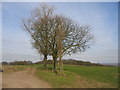
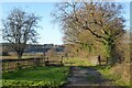
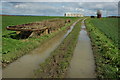
7 photos from this area
Area Information
Key information about the WR11 4SZ including its size, population, and administrative classification.
- Area Type
- Postcode
- Area Size
- 82.2 hectares
- Population
- 1214
- Population Density
- 41 people/km²
House Prices in WR11 4SZ
9
Properties
£407,289
Average Sold Price
£7,400
Lowest Price
£720,000
Highest Price
Showing 9 properties
| Address | Type | Beds | Baths | Last Sale Price | Last Sale Date | |
|---|---|---|---|---|---|---|
| Spring Hill Farm, Farm Lane, Atch Lench, WR11 4SZ | Bungalow | - | - | £720,000 | May 2022 | |
| North Farm Bungalow, Farm Lane, Atch Lench, WR11 4SZ | Retail | 3 | 2 | £641,125 | Apr 2022 | |
| The Byre, Farm Lane, Atch Lench, WR11 4SZ | Semi-detached | 3 | 1 | £7,400 | Aug 2021 | |
| The Dairy, Farm Lane, Atch Lench, WR11 4SZ | house | 4 | - | £550,000 | Mar 2021 | |
| The Tythe Barn, Farm Lane, Atch Lench, WR11 4SZ | house | 4 | - | £420,000 | Aug 2016 | |
| The Coach House, Farm Lane, Atch Lench, WR11 4SZ | Semi-detached | - | - | £495,000 | Oct 2007 | |
| Whitsun Oak, Farm Lane, Atch Lench, WR11 4SZ | Detached | - | - | £17,500 | Dec 1995 | |
| Mobile Home North Farm Bungalow, Farm Lane, Atch Lench, WR11 4SZ | Detached | - | - | - | - | |
| White Rails Farm, Farm Lane, Atch Lench, WR11 4SZ | Semi-detached | - | - | - | - |
Energy Efficiency in WR11 4SZ
Amenities
Schools
| Rank | School | Type | Entry gender | Ages |
|---|
Explore more schools in this area
Go to Schools tabDemographics
Household Size
Two person
most common
Accommodation Type
Houses
most common
Tenure
84
majority
Ethnic Group
White
most common
Religion
N/A
most common
Household Composition
N/A
most common
Age
47
median
Adults (30-64 years)
most common
Household Deprivation
N/A
with no deprivation
NS-SEC
44
in Lower managerial occupations
Explore more demographic insights in this area
Go to Demographics tabPlanning
Planning Constraints
- Flood RiskPremium
- Ramsar Wetland SitesPremium
- Area of Outstanding Natural BeautyPremium
- Protected Nature ReservePremium
- Protected WoodlandPremium