Area Overview for WR11 4SW
Photos of WR11 4SW
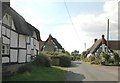
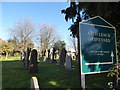

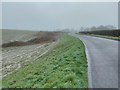
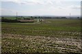
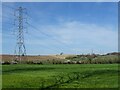
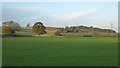
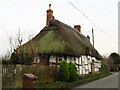
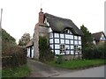
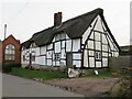
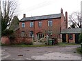
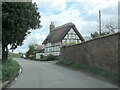
37 photos from this area
Area Information
Key information about the WR11 4SW including its size, population, and administrative classification.
- Area Type
- Postcode
- Area Size
- 1.0 km²
- Population
- 1214
- Population Density
- 41 people/km²
House Prices in WR11 4SW
41
Properties
£483,214
Average Sold Price
£55,000
Lowest Price
£1,500,000
Highest Price
Showing 41 properties
| Address | Type | Beds | Baths | Last Sale Price | Last Sale Date | |
|---|---|---|---|---|---|---|
| The Orchards, Atch Lench Road To Leys Road, Atch Lench, WR11 4SW | house | - | - | £840,000 | May 2025 | |
| Wooton, Atch Lench Road To Leys Road, Atch Lench, WR11 4SW | Bungalow | 4 | 2 | £585,000 | Aug 2023 | |
| Old Threshing Barn, Atch Lench Road To Leys Road, Atch Lench, WR11 4SW | Detached | 8 | 7 | £1,500,000 | Jul 2023 | |
| The Chapel, Atch Lench Road To Leys Road, Atch Lench, WR11 4SW | Detached | - | - | £300,000 | Dec 2021 | |
| Meadow Rise, Atch Lench Road To Leys Road, Atch Lench, WR11 4SW | Detached | 3 | 2 | £440,000 | Mar 2021 | |
| Taylors Hay Cottage, Atch Lench Road To Leys Road, Atch Lench, WR11 4SW | Semi-detached | 4 | - | £405,000 | Aug 2019 | |
| Little Orchard House, Atch Lench Road To Leys Road, Atch Lench, WR11 4SW | Detached | 5 | - | £900,000 | Jun 2017 | |
| 1, Manor Farm Cottages, Atch Lench Road To Leys Road, Atch Lench, WR11 4SW | Semi-detached | 2 | 1 | £174,000 | Oct 2015 | |
| Hunters Rise, Atch Lench Road To Leys Road, Atch Lench, WR11 4SW | Detached | 5 | - | £395,000 | Jun 2015 | |
| Martin House, Atch Lench Road To Leys Road, Atch Lench, WR11 4SW | Detached | 4 | 2 | £435,000 | Dec 2013 |
Page 1 of 5
Energy Efficiency in WR11 4SW
Amenities
Schools
| Rank | School | Type | Entry gender | Ages |
|---|
Explore more schools in this area
Go to Schools tabDemographics
Household Size
Two person
most common
Accommodation Type
Houses
most common
Tenure
84
majority
Ethnic Group
White
most common
Religion
N/A
most common
Household Composition
N/A
most common
Age
47
median
Adults (30-64 years)
most common
Household Deprivation
N/A
with no deprivation
NS-SEC
44
in Lower managerial occupations
Explore more demographic insights in this area
Go to Demographics tabPlanning
Planning Constraints
- Flood RiskPremium
- Ramsar Wetland SitesPremium
- Area of Outstanding Natural BeautyPremium
- Protected Nature ReservePremium
- Protected WoodlandPremium