Area Overview for WR10 1RQ
Photos of WR10 1RQ
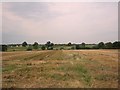

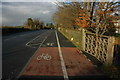
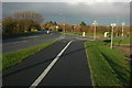
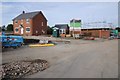
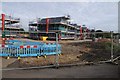
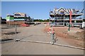
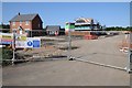
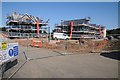
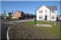
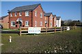
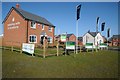
41 photos from this area
Area Information
Key information about the WR10 1RQ including its size, population, and administrative classification.
- Area Type
- Postcode
- Area Size
- 1.2 hectares
- Population
- 2432
- Population Density
- 545 people/km²
House Prices in WR10 1RQ
29
Properties
£279,127
Average Sold Price
£200,534
Lowest Price
£350,000
Highest Price
Showing 29 properties
| Address | Type | Beds | Baths | Last Sale Price | Last Sale Date | |
|---|---|---|---|---|---|---|
| 6 Jeacock Grove, Pershore, WR10 1RQ | Semi-detached | 3 | 1 | £269,500 | Dec 2022 | |
| 10 Jeacock Grove, Pershore, WR10 1RQ | house | - | - | £320,000 | Oct 2021 | |
| 2 Jeacock Grove, Pershore, WR10 1RQ | Bungalow | 3 | 2 | £320,000 | Sep 2020 | |
| 35 Jeacock Grove, Pershore, WR10 1RQ | Detached | 3 | 2 | £265,000 | Apr 2019 | |
| 37 Jeacock Grove, Pershore, WR10 1RQ | house | - | - | £270,000 | Dec 2018 | |
| 8 Jeacock Grove, Pershore, WR10 1RQ | house | - | - | £260,000 | Nov 2018 | |
| 20 Jeacock Grove, Pershore, WR10 1RQ | Bungalow | - | - | £330,000 | Oct 2018 | |
| 16 Jeacock Grove, Pershore, WR10 1RQ | house | - | - | £271,000 | Aug 2018 | |
| 39 Jeacock Grove, Pershore, WR10 1RQ | house | - | - | £350,000 | Jun 2018 | |
| 18 Jeacock Grove, Pershore, WR10 1RQ | house | - | - | £273,000 | Jun 2018 |
Page 1 of 3
Energy Efficiency in WR10 1RQ
Amenities
Schools
| Rank | School | Type | Entry gender | Ages |
|---|
Explore more schools in this area
Go to Schools tabDemographics
Household Size
Two person
most common
Accommodation Type
Houses
most common
Tenure
59
majority
Ethnic Group
White
most common
Religion
N/A
most common
Household Composition
N/A
most common
Age
47
median
Adults (30-64 years)
most common
Household Deprivation
N/A
with no deprivation
NS-SEC
31
in Lower managerial occupations
Explore more demographic insights in this area
Go to Demographics tabPlanning
Planning Constraints
- Flood RiskPremium
- Ramsar Wetland SitesPremium
- Area of Outstanding Natural BeautyPremium
- Protected Nature ReservePremium
- Protected WoodlandPremium