Area Overview for WR10 1RP
Photos of WR10 1RP
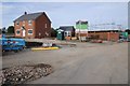
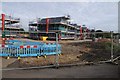
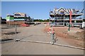
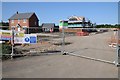
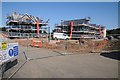
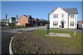
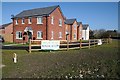
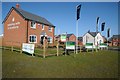
41 photos from this area
Area Information
Key information about the WR10 1RP including its size, population, and administrative classification.
- Area Type
- Postcode
- Area Size
- 2.9 hectares
- Population
- 2432
- Population Density
- 545 people/km²
House Prices in WR10 1RP
39
Properties
£263,567
Average Sold Price
£70,455
Lowest Price
£401,068
Highest Price
Showing 39 properties
| Address | Type | Beds | Baths | Last Sale Price | Last Sale Date | |
|---|---|---|---|---|---|---|
| 3 Krier Fields, Pershore, WR10 1RP | Semi-detached | 3 | 2 | £375,000 | Jan 2025 | |
| 44 Krier Fields, Pershore, WR10 1RP | Detached | 4 | 2 | £395,000 | Nov 2022 | |
| 26 Krier Fields, Pershore, WR10 1RP | Semi-detached | 3 | 1 | £260,000 | Apr 2022 | |
| 2 Krier Fields, Pershore, WR10 1RP | Semi-detached | 3 | 1 | £260,000 | Mar 2022 | |
| 24 Krier Fields, Pershore, WR10 1RP | Detached | 3 | 2 | £240,000 | Aug 2021 | |
| 25 Krier Fields, Pershore, WR10 1RP | Bungalow | - | - | £325,000 | Jun 2018 | |
| 46 Krier Fields, Pershore, WR10 1RP | house | - | - | £275,000 | Jun 2018 | |
| 38 Krier Fields, Pershore, WR10 1RP | Detached | 3 | 2 | £271,000 | Feb 2018 | |
| 28 Krier Fields, Pershore, WR10 1RP | house | - | - | £210,000 | Feb 2018 | |
| 22 Krier Fields, Pershore, WR10 1RP | house | - | - | £205,000 | Feb 2018 |
Page 1 of 4
Energy Efficiency in WR10 1RP
Amenities
Schools
| Rank | School | Type | Entry gender | Ages |
|---|
Explore more schools in this area
Go to Schools tabDemographics
Household Size
Two person
most common
Accommodation Type
Houses
most common
Tenure
59
majority
Ethnic Group
White
most common
Religion
N/A
most common
Household Composition
N/A
most common
Age
47
median
Adults (30-64 years)
most common
Household Deprivation
N/A
with no deprivation
NS-SEC
31
in Lower managerial occupations
Explore more demographic insights in this area
Go to Demographics tabPlanning
Planning Constraints
- Flood RiskPremium
- Ramsar Wetland SitesPremium
- Area of Outstanding Natural BeautyPremium
- Protected Nature ReservePremium
- Protected WoodlandPremium