Area Overview for WR10 1JG
Photos of WR10 1JG
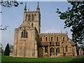
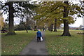

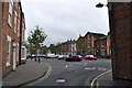
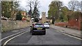
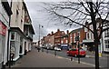
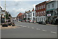
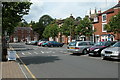
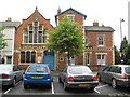

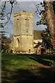
100 photos from this area
Area Information
Key information about the WR10 1JG including its size, population, and administrative classification.
- Area Type
- Postcode
- Area Size
- 1.2 hectares
- Population
- 1335
- Population Density
- 2937 people/km²
House Prices in WR10 1JG
39
Properties
£188,435
Average Sold Price
£68,500
Lowest Price
£315,000
Highest Price
Showing 39 properties
| Address | Type | Beds | Baths | Last Sale Price | Last Sale Date | |
|---|---|---|---|---|---|---|
| 17 Masons Ryde, Pershore, WR10 1JG | house | 2 | - | £191,000 | Oct 2024 | |
| 32 Masons Ryde, Pershore, WR10 1JG | house | 3 | 2 | £315,000 | May 2024 | |
| 18 Masons Ryde, Pershore, WR10 1JG | Terraced | 3 | 1 | £230,000 | Sep 2023 | |
| 21 Masons Ryde, Pershore, WR10 1JG | Terraced | 2 | 2 | £230,000 | May 2022 | |
| 20 Masons Ryde, Pershore, WR10 1JG | Terraced | 2 | 1 | £222,500 | Sep 2021 | |
| 23 Masons Ryde, Pershore, WR10 1JG | Semi-detached | 2 | 1 | £200,000 | Jan 2019 | |
| 15 Masons Ryde, Pershore, WR10 1JG | house | - | - | £188,250 | May 2018 | |
| The Corner House, Masons Ryde, Pershore, WR10 1JG | house | - | - | £315,000 | Dec 2017 | |
| 30 Masons Ryde, Pershore, WR10 1JG | house | 3 | 2 | £248,000 | Oct 2017 | |
| Ashton View, Masons Ryde, Pershore, WR10 1JG | house | 3 | - | £300,000 | Mar 2017 |
Page 1 of 4
Energy Efficiency in WR10 1JG
Amenities
Schools
| Rank | School | Type | Entry gender | Ages |
|---|
Explore more schools in this area
Go to Schools tabDemographics
Household Size
One person
most common
Accommodation Type
Houses
most common
Tenure
42
majority
Ethnic Group
White
most common
Religion
N/A
most common
Household Composition
N/A
most common
Age
47
median
Adults (30-64 years)
most common
Household Deprivation
N/A
with no deprivation
NS-SEC
26
in Lower managerial occupations
Explore more demographic insights in this area
Go to Demographics tabPlanning
Planning Constraints
- Flood RiskPremium
- Ramsar Wetland SitesPremium
- Area of Outstanding Natural BeautyPremium
- Protected Nature ReservePremium
- Protected WoodlandPremium