Area Overview for WR10 1AX
Photos of WR10 1AX
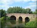


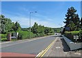
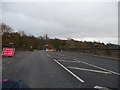

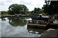
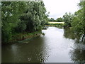


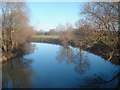
100 photos from this area
Area Information
Key information about the WR10 1AX including its size, population, and administrative classification.
- Area Type
- Postcode
- Area Size
- 4.9 hectares
- Population
- 1446
- Population Density
- 428 people/km²
House Prices in WR10 1AX
31
Properties
£302,541
Average Sold Price
£110,000
Lowest Price
£550,000
Highest Price
Showing 31 properties
| Address | Type | Beds | Baths | Last Sale Price | Last Sale Date | |
|---|---|---|---|---|---|---|
| 72 Bridge Street, Pershore, WR10 1AX | Semi-detached | 4 | 2 | £485,000 | Jan 2025 | |
| 2, The Old Malthouse, Bridge Street, Pershore, WR10 1AX | Terraced | 2 | 1 | £249,950 | Jun 2023 | |
| Mogridge House Pershore Manor, 78C Bridge Street, Pershore, WR10 1AX | Terraced | - | - | £110,000 | Jul 2022 | |
| The Old Court House, 58 Bridge Street, Pershore, WR10 1AX | house | - | - | £485,000 | May 2022 | |
| Dungannon House, 74 Bridge Street, Pershore, WR10 1AX | Detached | 6 | 3 | £550,000 | Apr 2021 | |
| Avondale, 76 Bridge Street, Pershore, WR10 1AX | Terraced | 5 | 2 | £440,000 | Apr 2021 | |
| Turberville Court Pershore Manor, 78A Bridge Street, Pershore, WR10 1AX | Detached | 4 | 3 | £120,000 | Mar 2021 | |
| 3, The Old Malthouse, Bridge Street, Pershore, WR10 1AX | house | 2 | 1 | £220,000 | Apr 2017 | |
| 56 Bridge Street, Pershore, WR10 1AX | Semi-detached | - | - | £275,000 | Aug 2008 | |
| 82 Bridge Street, Pershore, WR10 1AX | Detached | - | - | £249,999 | May 2004 |
Page 1 of 4
Energy Efficiency in WR10 1AX
Amenities
Schools
| Rank | School | Type | Entry gender | Ages |
|---|
Explore more schools in this area
Go to Schools tabDemographics
Household Size
Two person
most common
Accommodation Type
Houses
most common
Tenure
74
majority
Ethnic Group
White
most common
Religion
N/A
most common
Household Composition
N/A
most common
Age
47
median
Adults (30-64 years)
most common
Household Deprivation
N/A
with no deprivation
NS-SEC
34
in Lower managerial occupations
Explore more demographic insights in this area
Go to Demographics tabPlanning
Planning Constraints
- Flood RiskPremium
- Ramsar Wetland SitesPremium
- Area of Outstanding Natural BeautyPremium
- Protected Nature ReservePremium
- Protected WoodlandPremium