Area Overview for Warndon
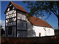
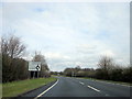
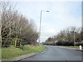
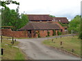
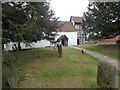
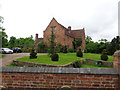
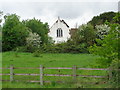
Photos of Warndon


Area Information
Warndon is a compact locality within the county electoral division of England, covering just 4.7 square kilometres. The area contains a population of 3,503 residents, resulting in a density of 750 people per square kilometre. This moderate density suggests a neighbourhood that is neither sprawling nor overcrowded, offering a balance between community proximity and private space. Living in Warndon means navigating a defined area where daily life is likely centred around established local patterns rather than rapid urban expansion. The demographic profile reveals a community with a median age of 70, indicating a area significantly populated by older adults. This age distribution shapes the local character, creating an environment tailored towards retirees and those seeking a quieter residential setting. You will find that the pace of life here reflects this older demographic, with amenities and services likely oriented towards the needs of an established population rather than young families or transient workers. The area's small size ensures that residents know their surroundings well, fostering a sense of familiarity across the entire 4.7 square kilometre expanse. For anyone considering homes in Warndon, the scale of the area promotes a manageable lifestyle where distances to local facilities remain short.
- Area Type
- Parish
- Area Size
- 4.7 km²
- Population
- 3503
- Population Density
- 750 people/km²
Demographics
The community profile of Warndon is defined by a pronounced shift towards an older population. With a median age of 70, the neighbourhood skews heavily towards retirees and older adults. This age concentration influences the social fabric and local需求的, creating an environment where community support often centres on elderly residents. Of the total households, 72% of homes are owner-occupied, reflecting a deep sense of settlement within the area. High ownership rates suggest that many families have lived in Warndon for decades, passing through generations or choosing stability over mobility. Accommodation types in the area likely reflect this demographic, prioritising single-storey properties or homes with lower maintenance requirements. The home ownership figure indicates a relatively static market where buyers typically hold onto their properties for long periods. Diversity metrics are not detailed in the available records, so the focus remains on the clear age-related trends. For those looking at schools near Warndon, the median age of 70 implies that very few children reside locally, meaning primary and secondary education facilities may serve populations drawn from wider surrounding areas rather than this specific county electoral division.
Household Size
Accommodation Type
Tenure
Ethnic Group
Religion
Household Composition
Age
Household Deprivation
NS-SEC
Explore more demographic insights in this area
Go to Demographics tabPlanning
Planning Constraints
- Flood RiskPremium
- Ramsar Wetland SitesPremium
- Area of Outstanding Natural BeautyPremium
- Protected Nature ReservePremium
- Protected WoodlandPremium