Area Overview for Worcester
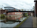
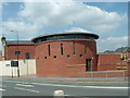
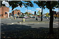
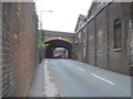
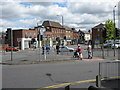
Photos of Worcester
Area Information
Worcester is a compact built-up area in England, spanning 25.7 km² and home to 34,215 residents. Its population density of 1,332 people per square kilometre reflects a mix of urban and suburban living. The town balances historical character with modern infrastructure, offering a range of amenities within practical reach. Residents benefit from proximity to four railway stations, including Worcester Shrub Hill and Worcestershire Parkway, which connect to major routes. For daily life, the area provides access to five primary schools, such as Cherry Orchard Primary School and Gorse Hill Community Primary School, ensuring educational options for families. Worcester’s compact size means most services and attractions are within walking or cycling distance, making it appealing for those seeking convenience without sacrificing space. The town’s appeal lies in its accessibility, with digital connectivity scores of 94 for broadband and 85 for mobile coverage, supporting both work and leisure. While the population is relatively aged, with a median age of 70, the area remains a practical choice for those prioritising ease of movement and proximity to essential services. Living in Worcester means navigating a well-connected, compact environment where daily needs are met without the sprawl of larger cities.
- Area Type
- Built Up Area 250
- Area Size
- 25.7 km²
- Population
- 34215
- Population Density
- 1332 people/km²
Residents of Worcester have access to a range of amenities within walking or cycling distance. Retail options include Aldi Worcester, Farmfoods Worcester, and Lidl Ronkswood, providing convenient shopping for daily essentials. The four railway stations—Worcester Shrub Hill, Worcester Foregate Street, and Worcestershire Parkway—offer easy access to regional and national travel, enhancing connectivity for commuters and travelers. For families, the five primary schools in the area, such as Cherry Orchard Primary School and Gorse Hill Community Primary School, are strategically located to support a school-focused lifestyle. Parks and open spaces, while not explicitly named in the data, are likely present in a town of this size, contributing to a balanced lifestyle. The compact nature of Worcester means that most services and attractions are within reach, reducing the need for long commutes. This accessibility fosters a sense of community, where residents can easily engage with local amenities, from retail to education. The lifestyle in Worcester is defined by convenience, with proximity to essential services and transport options shaping daily routines.
Amenities
Schools
Worcester is served by five primary schools, including Cherry Orchard Primary School, Cranham Primary School, and Dines Green Primary School. These institutions cater to younger children, offering foundational education in a local context. The presence of multiple primary schools ensures families have options, though no Ofsted ratings are provided to assess quality. The mix of school names suggests a variety of educational environments, potentially including community-focused institutions like Gorse Hill Community Primary School. For parents, the proximity of these schools to residential areas is a key consideration, as it reduces commuting time and supports a family-oriented lifestyle. The availability of five primary schools in a compact area also indicates a focus on early education infrastructure, which may be a draw for families prioritising schooling. However, without specific data on secondary education or school performance, buyers should conduct further research if academic standards are a priority. Worcester’s schools reflect the town’s commitment to education, but their effectiveness remains an area for individual investigation.
| Rank | School | Type | Entry gender | Ages |
|---|
Explore more schools in this area
Go to Schools tabDemographics
Worcester’s population has a median age of 70, indicating a community skewed towards older residents. This age profile influences household composition and accommodation types, though specific data on household structures is not available. Home ownership stands at 65%, suggesting a mix of owner-occupied properties and rental units. The area’s demographic data does not specify ethnic or religious diversity, but the overall population density of 1,332 people per km² implies a compact, closely knit community. The high median age may affect local services and amenities, with demand for healthcare and leisure facilities likely to be significant. For buyers, this demographic profile means a market shaped by older residents seeking stability, though younger families may find fewer options compared to more diverse areas. The lack of detailed data on household types or ethnic composition means assumptions about community dynamics must be avoided. Worcester’s demographic reality is one of a mature population, with property and service needs reflecting this age group’s priorities.