Area Overview for TF1 5WR
Photos of TF1 5WR

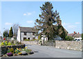
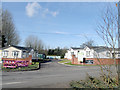
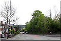
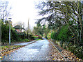

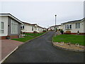
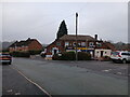
83 photos from this area
Area Information
Key information about the TF1 5WR including its size, population, and administrative classification.
- Area Type
- Postcode
- Area Size
- 2.3 hectares
- Population
- 1721
- Population Density
- 2645 people/km²
House Prices in TF1 5WR
38
Properties
£112,079
Average Sold Price
£50,500
Lowest Price
£195,000
Highest Price
Showing 38 properties
| Address | Type | Beds | Baths | Last Sale Price | Last Sale Date | |
|---|---|---|---|---|---|---|
| 31 Snowdrop Meadow, Ketley, Telford, TF1 5WR | house | 3 | - | £195,000 | Sep 2024 | |
| 16 Snowdrop Meadow, Ketley, Telford, TF1 5WR | Semi-detached | 2 | 1 | £150,000 | Feb 2024 | |
| 39 Snowdrop Meadow, Ketley, Telford, TF1 5WR | house | - | - | £118,000 | Apr 2022 | |
| 18 Snowdrop Meadow, Ketley, Telford, TF1 5WR | Terraced | 2 | 1 | £134,000 | Feb 2021 | |
| 43 Snowdrop Meadow, Ketley, Telford, TF1 5WR | Terraced | 2 | 1 | £125,000 | Apr 2020 | |
| 19 Snowdrop Meadow, Ketley, Telford, TF1 5WR | Terraced | 2 | 1 | £132,500 | Jul 2018 | |
| 11 Snowdrop Meadow, Ketley, Telford, TF1 5WR | Terraced | 2 | 1 | £118,250 | May 2018 | |
| 47 Snowdrop Meadow, Ketley, Telford, TF1 5WR | house | 2 | 1 | £113,000 | Apr 2018 | |
| 29 Snowdrop Meadow, Ketley, Telford, TF1 5WR | Semi-detached | 3 | 1 | £147,000 | Oct 2017 | |
| 5 Snowdrop Meadow, Ketley, Telford, TF1 5WR | Semi-detached | 3 | 1 | £147,500 | Jul 2017 |
Page 1 of 4
Energy Efficiency in TF1 5WR
Amenities
Schools
| Rank | School | Type | Entry gender | Ages |
|---|
Explore more schools in this area
Go to Schools tabDemographics
Household Size
Two person
most common
Accommodation Type
Houses
most common
Tenure
60
majority
Ethnic Group
White
most common
Religion
N/A
most common
Household Composition
N/A
most common
Age
47
median
Adults (30-64 years)
most common
Household Deprivation
N/A
with no deprivation
NS-SEC
27
in Lower managerial occupations
Explore more demographic insights in this area
Go to Demographics tabPlanning
Planning Constraints
- Flood RiskPremium
- Ramsar Wetland SitesPremium
- Area of Outstanding Natural BeautyPremium
- Protected Nature ReservePremium
- Protected WoodlandPremium