Area Overview for TF1 5EH
Photos of TF1 5EH

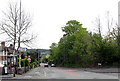
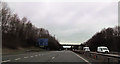
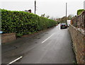
83 photos from this area
Area Information
Key information about the TF1 5EH including its size, population, and administrative classification.
- Area Type
- Postcode
- Area Size
- 4.2 hectares
- Population
- 1594
- Population Density
- 2158 people/km²
House Prices in TF1 5EH
30
Properties
£269,393
Average Sold Price
£91,000
Lowest Price
£800,000
Highest Price
Showing 30 properties
| Address | Type | Beds | Baths | Last Sale Price | Last Sale Date | |
|---|---|---|---|---|---|---|
| 66 Shepherds Lane, Red Lake, Telford, TF1 5EH | Cottage | 3 | 1 | £165,000 | Aug 2023 | |
| Beechwood, Shepherds Lane, Red Lake, Telford, TF1 5EH | Bungalow | 2 | 1 | £225,000 | Mar 2023 | |
| Woodlands House, Shepherds Lane, Red Lake, Telford, TF1 5EH | house | - | - | £455,000 | Dec 2022 | |
| Sutherland House, 72 Shepherds Lane, Red Lake, Telford, TF1 5EH | Semi-detached | 4 | 2 | £312,000 | Sep 2021 | |
| The Old Hall, Shepherds Lane, Red Lake, Telford, TF1 5EH | Detached | 4 | 4 | £550,000 | Aug 2021 | |
| The Old Vicarage, Shepherds Lane, Red Lake, Telford, TF1 5EH | Detached | 6 | - | £800,000 | Feb 2021 | |
| 78 Shepherds Lane, Red Lake, Telford, TF1 5EH | Detached | 4 | 2 | £274,950 | Aug 2019 | |
| Woodstock, Shepherds Lane, Red Lake, Telford, TF1 5EH | Bungalow | 4 | 2 | £305,000 | Jan 2019 | |
| 73 Shepherds Lane, Red Lake, Telford, TF1 5EH | house | - | - | £257,000 | Dec 2018 | |
| Woodgate Cottage, Shepherds Lane, Red Lake, Telford, TF1 5EH | Semi-detached | 3 | 2 | £230,000 | Jul 2018 |
Page 1 of 3
Energy Efficiency in TF1 5EH
Amenities
Schools
| Rank | School | Type | Entry gender | Ages |
|---|
Explore more schools in this area
Go to Schools tabDemographics
Household Size
Two person
most common
Accommodation Type
Houses
most common
Tenure
77
majority
Ethnic Group
White
most common
Religion
N/A
most common
Household Composition
N/A
most common
Age
47
median
Adults (30-64 years)
most common
Household Deprivation
N/A
with no deprivation
NS-SEC
34
in Lower managerial occupations
Explore more demographic insights in this area
Go to Demographics tabPlanning
Planning Constraints
- Flood RiskPremium
- Ramsar Wetland SitesPremium
- Area of Outstanding Natural BeautyPremium
- Protected Nature ReservePremium
- Protected WoodlandPremium