Area Overview for SY8 4JG
Photos of SY8 4JG

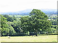
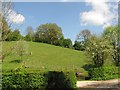
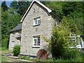

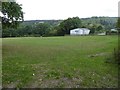

8 photos from this area
Area Information
Key information about the SY8 4JG including its size, population, and administrative classification.
- Area Type
- Postcode
- Area Size
- 94.7 hectares
- Population
- 1417
- Population Density
- 52 people/km²
House Prices in SY8 4JG
31
Properties
£390,583
Average Sold Price
£90,000
Lowest Price
£937,500
Highest Price
Showing 31 properties
| Address | Type | Beds | Baths | Last Sale Price | Last Sale Date | |
|---|---|---|---|---|---|---|
| Waterloo Lodge, Waterloo Road, Orleton, SY8 4JG | house | 6 | 5 | £665,000 | Mar 2025 | |
| Chapel House, Waterloo Road, Orleton, SY8 4JG | Detached | 2 | 1 | £151,000 | Jun 2022 | |
| Broad Green Cottage, Green Lane, Orleton, SY8 4JG | house | - | - | £937,500 | Jan 2021 | |
| Little Waterloo, Waterloo Road, Orleton, SY8 4JG | house | - | - | £490,000 | Oct 2019 | |
| Spring Cottage, Waterloo Road, Orleton, SY8 4JG | house | - | - | £390,000 | Sep 2017 | |
| Brook House, Waterloo Road, Orleton, SY8 4JG | house | - | - | £385,000 | Apr 2016 | |
| The White House, Cullis Pitch From Woodhouse Lane, Orleton, SY8 4JG | Bungalow | - | - | £493,493 | Jan 2015 | |
| Rock Cottage, Green Lane, Orleton, SY8 4JG | house | - | - | £280,000 | Mar 2011 | |
| Spout House Lodge, Green Lane, Orleton, SY8 4JG | house | - | - | £410,000 | Jul 2007 | |
| Sunnybank, Cullis Pitch From Woodhouse Lane, Orleton, SY8 4JG | Detached | - | - | £90,000 | Jan 2002 |
Page 1 of 4
Energy Efficiency in SY8 4JG
Amenities
Schools
| Rank | School | Type | Entry gender | Ages |
|---|
Explore more schools in this area
Go to Schools tabDemographics
Household Size
Two person
most common
Accommodation Type
Houses
most common
Tenure
84
majority
Ethnic Group
White
most common
Religion
N/A
most common
Household Composition
N/A
most common
Age
47
median
Adults (30-64 years)
most common
Household Deprivation
N/A
with no deprivation
NS-SEC
39
in Lower managerial occupations
Explore more demographic insights in this area
Go to Demographics tabPlanning
Planning Constraints
- Flood RiskPremium
- Ramsar Wetland SitesPremium
- Area of Outstanding Natural BeautyPremium
- Protected Nature ReservePremium
- Protected WoodlandPremium