Area Overview for SY8 1DZ
Photos of SY8 1DZ
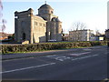
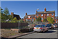
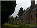
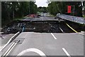
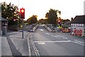
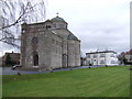
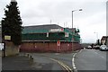
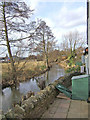
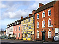
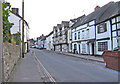
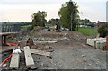
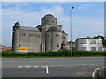
100 photos from this area
Area Information
Key information about the SY8 1DZ including its size, population, and administrative classification.
- Area Type
- Postcode
- Area Size
- 5882 m²
- Population
- 1255
- Population Density
- 639 people/km²
House Prices in SY8 1DZ
13
Properties
£164,786
Average Sold Price
£42,000
Lowest Price
£330,000
Highest Price
Showing 13 properties
| Address | Type | Beds | Baths | Last Sale Price | Last Sale Date | |
|---|---|---|---|---|---|---|
| Mews View, St Marys Lane, Ludlow, SY8 1DZ | Terraced | 2 | 1 | £147,500 | Apr 2024 | |
| 2, Bridgeside, St Marys Lane, Ludlow, SY8 1DZ | house | - | - | £330,000 | Nov 2022 | |
| 1, Bridgeside, St Marys Lane, Ludlow, SY8 1DZ | Semi-detached | 2 | 2 | £235,000 | Aug 2020 | |
| 13 St Marys Lane, Ludlow, SY8 1DZ | house | - | - | £110,000 | May 2010 | |
| 15 St Marys Lane, Ludlow, SY8 1DZ | Terraced | - | - | £129,000 | Nov 2004 | |
| Oak Cottage, St Marys Lane, Ludlow, SY8 1DZ | Cottage | 2 | - | £160,000 | Apr 2002 | |
| 11 St Marys Lane, Ludlow, SY8 1DZ | Terraced | 3 | - | £42,000 | Jun 1997 | |
| St Marys House, 12 St Marys Lane, Ludlow, SY8 1DZ | Semi-detached | - | - | - | - | |
| 14 St Marys Lane, Ludlow, SY8 1DZ | Terraced | - | - | - | - | |
| 8 St Marys Lane, Ludlow, SY8 1DZ | Terraced | - | - | - | - |
Page 1 of 2
Energy Efficiency in SY8 1DZ
Amenities
Schools
| Rank | School | Type | Entry gender | Ages |
|---|
Explore more schools in this area
Go to Schools tabDemographics
Household Size
One person
most common
Accommodation Type
Houses
most common
Tenure
71
majority
Ethnic Group
White
most common
Religion
N/A
most common
Household Composition
N/A
most common
Age
70
median
Elderly (65+ years)
most common
Household Deprivation
N/A
with no deprivation
NS-SEC
43
in Lower managerial occupations
Explore more demographic insights in this area
Go to Demographics tabPlanning
Planning Constraints
- Flood RiskPremium
- Ramsar Wetland SitesPremium
- Area of Outstanding Natural BeautyPremium
- Protected Nature ReservePremium
- Protected WoodlandPremium