Area Overview for SY8 2LU
Photos of SY8 2LU
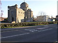
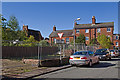
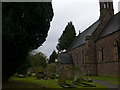
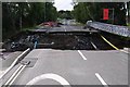
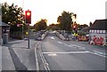
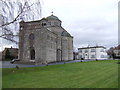
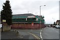
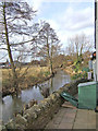
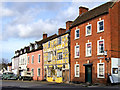
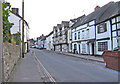
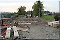
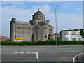
100 photos from this area
Area Information
Key information about the SY8 2LU including its size, population, and administrative classification.
- Area Type
- Postcode
- Area Size
- 2.6 hectares
- Population
- 1230
- Population Density
- 2329 people/km²
House Prices in SY8 2LU
31
Properties
£223,368
Average Sold Price
£29,000
Lowest Price
£500,000
Highest Price
Showing 31 properties
| Address | Type | Beds | Baths | Last Sale Price | Last Sale Date | |
|---|---|---|---|---|---|---|
| 8 Fishmore Road, Ludlow, SY8 2LU | Semi-detached | 3 | 1 | £240,000 | Oct 2024 | |
| Hopedene, Fishmore Road, Ludlow, SY8 2LU | Bungalow | 2 | 1 | £310,000 | Apr 2024 | |
| Bravinium, Fishmore Road, Ludlow, SY8 2LU | Land | - | - | £290,000 | Apr 2022 | |
| Lyndale, Fishmore Road, Ludlow, SY8 2LU | Bungalow | 3 | - | £285,000 | Mar 2022 | |
| Appletree Cottage, 20 Fishmore Road, Ludlow, SY8 2LU | house | - | - | £333,500 | Oct 2021 | |
| The Gables, Fishmore Road, Ludlow, SY8 2LU | house | - | - | £500,000 | Jun 2021 | |
| Glendene, Fishmore Road, Ludlow, SY8 2LU | Bungalow | 2 | 1 | £233,000 | May 2021 | |
| 15 Fishmore Road, Ludlow, SY8 2LU | house | - | - | £259,000 | Mar 2021 | |
| Milverton, Fishmore Road, Ludlow, SY8 2LU | Detached | 3 | 1 | £266,000 | Jan 2020 | |
| Will Der Ness, Fishmore Road, Ludlow, SY8 2LU | Detached | - | - | £283,000 | Sep 2019 |
Page 1 of 4
Energy Efficiency in SY8 2LU
Amenities
Schools
| Rank | School | Type | Entry gender | Ages |
|---|
Explore more schools in this area
Go to Schools tabDemographics
Household Size
Two person
most common
Accommodation Type
Houses
most common
Tenure
80
majority
Ethnic Group
White
most common
Religion
N/A
most common
Household Composition
N/A
most common
Age
47
median
Adults (30-64 years)
most common
Household Deprivation
N/A
with no deprivation
NS-SEC
31
in Lower managerial occupations
Explore more demographic insights in this area
Go to Demographics tabPlanning
Planning Constraints
- Flood RiskPremium
- Ramsar Wetland SitesPremium
- Area of Outstanding Natural BeautyPremium
- Protected Nature ReservePremium
- Protected WoodlandPremium