Area Overview for SY7 0EE
Photos of SY7 0EE
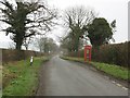
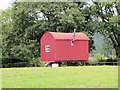
![Wanderings around the Welsh/English border [234] in SY7 0EE](https://images.propbar.co.uk/images/geograph/75/52/7552602_120.jpg)
8 photos from this area
Area Information
Key information about the SY7 0EE including its size, population, and administrative classification.
- Area Type
- Postcode
- Area Size
- 2.5 km²
- Population
- 1835
- Population Density
- 43 people/km²
House Prices in SY7 0EE
19
Properties
£311,625
Average Sold Price
£240,000
Lowest Price
£470,000
Highest Price
Showing 19 properties
| Address | Type | Beds | Baths | Last Sale Price | Last Sale Date | |
|---|---|---|---|---|---|---|
| Forest Croft, C 1009 From Ongar Street Via Cross Of The Tree, Lingen Deerfold, SY7 0EE | house | - | - | £286,500 | Jul 2018 | |
| Wetmore Cottage, Grove Head Road, Lingen Deerfold, SY7 0EE | Detached | 2 | 2 | £250,000 | Mar 2018 | |
| Grove Head, Grove Head Road, Lingen Deerfold, SY7 0EE | Detached | - | - | £470,000 | Dec 2004 | |
| Beech Cottage, C 1009 From Ongar Street Via Cross Of The Tree, Lingen Deerfold, SY7 0EE | Detached | - | - | £240,000 | May 2002 | |
| Cross Of The Tree Farm, Haven Lane From C 1009, Lingen Deerfold, SY7 0EE | Detached | 3 | 2 | - | - | |
| Deerfold Farm, C 1009 From Ongar Street Via Cross Of The Tree, Lingen Deerfold, SY7 0EE | Detached | 3 | 2 | - | - | |
| Snow Drop Cottage, C 1009 From Ongar Street Via Cross Of The Tree, Lingen Deerfold, SY7 0EE | Detached | - | - | - | - | |
| Deepmoor Farm, Haven Lane From C 1009, Lingen Deerfold, SY7 0EE | Detached | - | - | - | - | |
| Cottage, Cross Of The Tree Farm, Haven Lane From C 1009, Lingen Deerfold, SY7 0EE | Detached | - | - | - | - | |
| Lower Woodbatch, Pig And Whistle Road, Lingen Deerfold, SY7 0EE | Detached | - | - | - | - |
Page 1 of 2
Energy Efficiency in SY7 0EE
Amenities
Schools
| Rank | School | Type | Entry gender | Ages |
|---|
Explore more schools in this area
Go to Schools tabDemographics
Household Size
Two person
most common
Accommodation Type
Houses
most common
Tenure
68
majority
Ethnic Group
White
most common
Religion
N/A
most common
Household Composition
N/A
most common
Age
47
median
Adults (30-64 years)
most common
Household Deprivation
N/A
with no deprivation
NS-SEC
33
in Lower managerial occupations
Explore more demographic insights in this area
Go to Demographics tabPlanning
Planning Constraints
- Flood RiskPremium
- Ramsar Wetland SitesPremium
- Area of Outstanding Natural BeautyPremium
- Protected Nature ReservePremium
- Protected WoodlandPremium