Area Overview for SY22 6EJ
Photos of SY22 6EJ
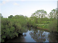
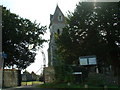
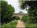
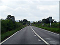

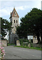
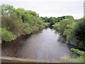
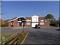
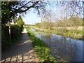
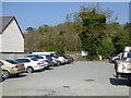
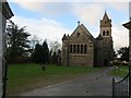
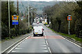
52 photos from this area
Area Information
Key information about the SY22 6EJ including its size, population, and administrative classification.
- Area Type
- Postcode
- Area Size
- 4722 m²
- Population
- 1552
- Population Density
- 248 people/km²
House Prices in SY22 6EJ
12
Properties
£168,000
Average Sold Price
£156,000
Lowest Price
£180,000
Highest Price
Showing 12 properties
| Address | Type | Beds | Baths | Last Sale Price | Last Sale Date | |
|---|---|---|---|---|---|---|
| Glen Rose, The Street, Llanymynech, SY22 6EJ | house | - | - | £180,000 | Feb 2021 | |
| Newport House, The Street, Llanymynech, SY22 6EJ | Semi-detached | 2 | 1 | £156,000 | Feb 2021 | |
| Bradford Arms, The Street, Llanymynech, SY22 6EJ | hotel | - | - | - | - | |
| The Stables, Bradford Terrace, The Street, Llanymynech, SY22 6EJ | Terraced | - | - | - | - | |
| Vyrnwy Filling Station, The Street, Llanymynech, SY22 6EJ | Retail | - | - | - | - | |
| Bradford House, Bradford Terrace, The Street, Llanymynech, SY22 6EJ | hotel | - | - | - | - | |
| Trevarrion, The Street, Llanymynech, SY22 6EJ | house | - | - | - | - | |
| New Bungalow, Rectory Lane, Llanymynech, SY22 6EJ | Bungalow | - | - | - | - | |
| Rw Car Sales, Vyrnwy Filling Station, Chapel Lane, Llanymynech, SY22 6EJ | commercial | - | - | - | - | |
| Prospect House, The Street, Llanymynech, SY22 6EJ | Semi-detached | - | - | - | - |
Page 1 of 2
Energy Efficiency in SY22 6EJ
Amenities
Schools
| Rank | School | Type | Entry gender | Ages |
|---|
Explore more schools in this area
Go to Schools tabDemographics
Household Size
Two person
most common
Accommodation Type
Houses
most common
Tenure
81
majority
Ethnic Group
White
most common
Religion
N/A
most common
Household Composition
N/A
most common
Age
47
median
Adults (30-64 years)
most common
Household Deprivation
N/A
with no deprivation
NS-SEC
37
in Lower managerial occupations
Explore more demographic insights in this area
Go to Demographics tabPlanning
Planning Constraints
- Flood RiskPremium
- Ramsar Wetland SitesPremium
- Area of Outstanding Natural BeautyPremium
- Protected Nature ReservePremium
- Protected WoodlandPremium