Area Overview for SY22 6ED
Photos of SY22 6ED
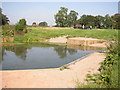
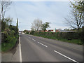
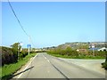
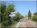
11 photos from this area
Area Information
Key information about the SY22 6ED including its size, population, and administrative classification.
- Area Type
- Postcode
- Area Size
- 4.6 hectares
- Population
- 1552
- Population Density
- 248 people/km²
House Prices in SY22 6ED
9
Properties
£139,254
Average Sold Price
£55,000
Lowest Price
£200,000
Highest Price
Showing 9 properties
| Address | Type | Beds | Baths | Last Sale Price | Last Sale Date | |
|---|---|---|---|---|---|---|
| The Old Post Office, Station Road, Llanymynech, SY22 6ED | Flat | - | - | £115,000 | Aug 2022 | |
| The Cottage, Station Road, Llanymynech, SY22 6ED | Semi-detached | 5 | - | £197,500 | Sep 2014 | |
| Springfields, B 4398 From Station Road Llanymynech To Llwyntidman Junction, Llanymynech, SY22 6ED | house | 4 | - | £200,000 | Jun 2006 | |
| 3, Rock View, Station Road, Llanymynech, SY22 6ED | Terraced | - | - | £128,770 | Jun 2006 | |
| New House Farm, Station Road, Llanymynech, SY22 6ED | house | - | - | £55,000 | Sep 1997 | |
| Holly House, 2 Station Road, Llanymynech, SY22 6ED | Terraced | - | - | - | - | |
| First Floor Flat, Bala House, Station Road, Llanymynech, SY22 6ED | Flat | - | - | - | - | |
| 1, Rock View, Station Road, Llanymynech, SY22 6ED | house | - | - | - | - | |
| 2, Rock View, Station Road, Llanymynech, SY22 6ED | Terraced | - | - | - | - |
Energy Efficiency in SY22 6ED
Amenities
Schools
| Rank | School | Type | Entry gender | Ages |
|---|
Explore more schools in this area
Go to Schools tabDemographics
Household Size
Two person
most common
Accommodation Type
Houses
most common
Tenure
81
majority
Ethnic Group
White
most common
Religion
N/A
most common
Household Composition
N/A
most common
Age
47
median
Adults (30-64 years)
most common
Household Deprivation
N/A
with no deprivation
NS-SEC
37
in Lower managerial occupations
Explore more demographic insights in this area
Go to Demographics tabPlanning
Planning Constraints
- Flood RiskPremium
- Ramsar Wetland SitesPremium
- Area of Outstanding Natural BeautyPremium
- Protected Nature ReservePremium
- Protected WoodlandPremium