Area Overview for SY2 5WE
Photos of SY2 5WE
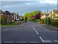
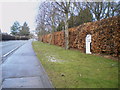
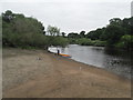
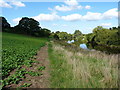
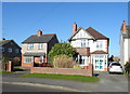
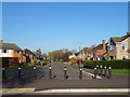
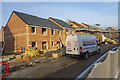

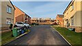
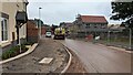
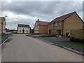
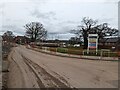
30 photos from this area
Area Information
Key information about the SY2 5WE including its size, population, and administrative classification.
- Area Type
- Postcode
- Area Size
- 1.8 hectares
- Population
- 1711
- Population Density
- 1422 people/km²
House Prices in SY2 5WE
54
Properties
£251,248
Average Sold Price
£79,000
Lowest Price
£377,500
Highest Price
Showing 54 properties
| Address | Type | Beds | Baths | Last Sale Price | Last Sale Date | |
|---|---|---|---|---|---|---|
| 13 Davison Drive, Shrewsbury, SY2 5WE | Detached | 3 | 2 | £295,000 | Mar 2025 | |
| 16 Davison Drive, Shrewsbury, SY2 5WE | house | - | - | £349,950 | Mar 2023 | |
| 46 Davison Drive, Shrewsbury, SY2 5WE | house | 5 | 3 | £374,950 | Dec 2022 | |
| 52 Davison Drive, Shrewsbury, SY2 5WE | house | - | - | £374,950 | Aug 2022 | |
| 80 Davison Drive, Shrewsbury, SY2 5WE | house | - | - | £349,950 | Jun 2022 | |
| 64 Davison Drive, Shrewsbury, SY2 5WE | house | - | - | £339,950 | Jun 2022 | |
| 48 Davison Drive, Shrewsbury, SY2 5WE | house | - | - | £377,500 | Jun 2022 | |
| 44 Davison Drive, Shrewsbury, SY2 5WE | house | - | - | £359,950 | May 2022 | |
| 50 Davison Drive, Shrewsbury, SY2 5WE | house | - | - | £359,950 | May 2022 | |
| 78 Davison Drive, Shrewsbury, SY2 5WE | Detached | 4 | 2 | £357,500 | May 2022 |
Page 1 of 6
Energy Efficiency in SY2 5WE
Amenities
Schools
| Rank | School | Type | Entry gender | Ages |
|---|
Explore more schools in this area
Go to Schools tabDemographics
Household Size
Two person
most common
Accommodation Type
Houses
most common
Tenure
90
majority
Ethnic Group
White
most common
Religion
N/A
most common
Household Composition
N/A
most common
Age
47
median
Adults (30-64 years)
most common
Household Deprivation
N/A
with no deprivation
NS-SEC
42
in Lower managerial occupations
Explore more demographic insights in this area
Go to Demographics tabPlanning
Planning Constraints
- Flood RiskPremium
- Ramsar Wetland SitesPremium
- Area of Outstanding Natural BeautyPremium
- Protected Nature ReservePremium
- Protected WoodlandPremium