Area Overview for SY2 5TH
Photos of SY2 5TH
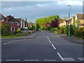
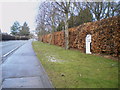
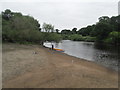
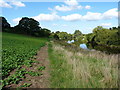
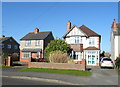
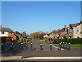
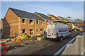
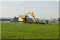
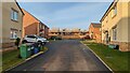
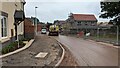
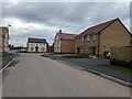
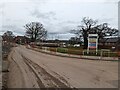
30 photos from this area
Area Information
Key information about the SY2 5TH including its size, population, and administrative classification.
- Area Type
- Postcode
- Area Size
- 4.2 hectares
- Population
- 1711
- Population Density
- 1422 people/km²
House Prices in SY2 5TH
89
Properties
£286,057
Average Sold Price
£97,282
Lowest Price
£458,750
Highest Price
Showing 89 properties
| Address | Type | Beds | Baths | Last Sale Price | Last Sale Date | |
|---|---|---|---|---|---|---|
| 103 Holland Drive, Shrewsbury, SY2 5TH | Terraced | 3 | 2 | £268,000 | Aug 2025 | |
| 161 Holland Drive, Shrewsbury, SY2 5TH | Detached | 4 | 2 | £400,000 | Aug 2025 | |
| 71 Holland Drive, Shrewsbury, SY2 5TH | Terraced | 2 | - | £224,000 | Jul 2025 | |
| 65 Holland Drive, Shrewsbury, SY2 5TH | Detached | 3 | 2 | £272,000 | Jul 2025 | |
| 117 Holland Drive, Shrewsbury, SY2 5TH | house | 3 | 2 | £325,000 | Jun 2025 | |
| 79 Holland Drive, Shrewsbury, SY2 5TH | house | - | - | £220,000 | Jun 2025 | |
| 75 Holland Drive, Shrewsbury, SY2 5TH | house | - | - | £282,500 | Mar 2025 | |
| 39 Holland Drive, Shrewsbury, SY2 5TH | house | - | - | £380,000 | Feb 2025 | |
| 19 Holland Drive, Shrewsbury, SY2 5TH | house | - | - | £275,000 | Dec 2024 | |
| 81 Holland Drive, Shrewsbury, SY2 5TH | house | - | - | £289,995 | Nov 2024 |
Page 1 of 9
Energy Efficiency in SY2 5TH
Amenities
Schools
| Rank | School | Type | Entry gender | Ages |
|---|
Explore more schools in this area
Go to Schools tabDemographics
Household Size
Two person
most common
Accommodation Type
Houses
most common
Tenure
90
majority
Ethnic Group
White
most common
Religion
N/A
most common
Household Composition
N/A
most common
Age
47
median
Adults (30-64 years)
most common
Household Deprivation
N/A
with no deprivation
NS-SEC
42
in Lower managerial occupations
Explore more demographic insights in this area
Go to Demographics tabPlanning
Planning Constraints
- Flood RiskPremium
- Ramsar Wetland SitesPremium
- Area of Outstanding Natural BeautyPremium
- Protected Nature ReservePremium
- Protected WoodlandPremium