Area Overview for SY1 2UT
Photos of SY1 2UT

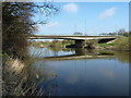
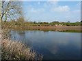
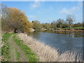
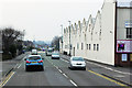
64 photos from this area
Area Information
Key information about the SY1 2UT including its size, population, and administrative classification.
- Area Type
- Postcode
- Area Size
- 1.7 hectares
- Population
- 1970
- Population Density
- 4209 people/km²
House Prices in SY1 2UT
45
Properties
£221,363
Average Sold Price
£140,995
Lowest Price
£367,500
Highest Price
Showing 45 properties
| Address | Type | Beds | Baths | Last Sale Price | Last Sale Date | |
|---|---|---|---|---|---|---|
| 24 Laburnum Grove, Spring Gardens, Shrewsbury, SY1 2UT | house | 3 | 2 | £240,000 | Sep 2025 | |
| 10 Laburnum Grove, Spring Gardens, Shrewsbury, SY1 2UT | Terraced | 3 | 2 | £235,000 | Nov 2024 | |
| 20 Laburnum Grove, Spring Gardens, Shrewsbury, SY1 2UT | house | 3 | 2 | £230,000 | Feb 2024 | |
| 2 Laburnum Grove, Spring Gardens, Shrewsbury, SY1 2UT | house | - | - | £295,000 | Jan 2024 | |
| 42 Laburnum Grove, Spring Gardens, Shrewsbury, SY1 2UT | house | - | - | £330,000 | Aug 2023 | |
| 31 Laburnum Grove, Spring Gardens, Shrewsbury, SY1 2UT | house | - | - | £341,000 | Jul 2023 | |
| 29 Laburnum Grove, Spring Gardens, Shrewsbury, SY1 2UT | Detached | 4 | 3 | £240,000 | Apr 2023 | |
| 33 Laburnum Grove, Spring Gardens, Shrewsbury, SY1 2UT | house | - | - | £367,500 | Sep 2022 | |
| 18 Laburnum Grove, Spring Gardens, Shrewsbury, SY1 2UT | Detached | 3 | 2 | £240,000 | Aug 2022 | |
| 52 Laburnum Grove, Spring Gardens, Shrewsbury, SY1 2UT | house | - | - | £229,995 | Jun 2022 |
Page 1 of 5
Energy Efficiency in SY1 2UT
Amenities
Schools
| Rank | School | Type | Entry gender | Ages |
|---|
Explore more schools in this area
Go to Schools tabDemographics
Household Size
One person
most common
Accommodation Type
Houses
most common
Tenure
58
majority
Ethnic Group
White
most common
Religion
N/A
most common
Household Composition
N/A
most common
Age
47
median
Adults (30-64 years)
most common
Household Deprivation
N/A
with no deprivation
NS-SEC
26
in Lower managerial occupations
Explore more demographic insights in this area
Go to Demographics tabPlanning
Planning Constraints
- Flood RiskPremium
- Ramsar Wetland SitesPremium
- Area of Outstanding Natural BeautyPremium
- Protected Nature ReservePremium
- Protected WoodlandPremium