Area Overview for Cheslyn Hay
Photos of Cheslyn Hay
Area Information
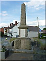
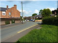
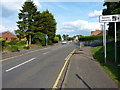
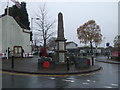
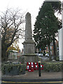
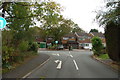
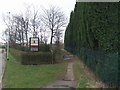
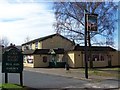
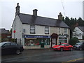
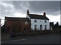
Cheslyn Hay is a civil parish situated within the South Staffordshire district of Staffordshire, covering an area of 3.8 square kilometres. You will find this village forming a built-up area with neighbouring communities such as Great Wyrley, Landywood, and Churchbridge. The population stands at 7,293 according to the 2011 census, creating a residential environment that balances suburban village life with proximity to larger towns. Located approximately three miles south of Cannock, ten miles north of Walsall, and thirteen miles south of Stafford, the parish appeals to those who value countryside access near the Cannock Chase Area of Outstanding Natural Beauty. Historical records date back to the fourteenth century when the area appeared as Luttelwode, and it has since expanded significantly post-World War II through housing built into surrounding fields. Local landmarks include St. Mark's Church, a nineteenth-century Victorian building, and the sixteenth-century Cheslyn Hay Old Hall. The village centre along Station Street hosts various small shops, pubs, and restaurants that serve the daily needs of residents. This setting provides a specific type of living character where countryside trails and wildlife opportunities sit alongside modern conveniences. You are looking at a community defined by its blend of historical heritage and contemporary suburban expansion, offering a distinct alternative to more urbanised locations in the West Midlands region.
- Area Type
- Parish
- Area Size
- 3.8 km²
- Population
- Not available
- Population Density
- Not available
Demographics
The community profile of Cheslyn Hay reveals a mature population structure centred around older demographics. The median age in the area is 70 years old, marking a significantly aged population compared to the wider national average. Although specific breakdowns for individual age ranges are not detailed in the available records, the high median age suggests that many homes here accommodate retired or elderly residents. Approximately 79 per cent of households in the parish own their homes, indicating a strong tradition of property ownership rather than renting. This high percentage of homeownership typically correlates with established neighbourhoods where long-term residents remain in their properties. The accommodation type data reflects this stability, pointing towards a stock dominated by owner-occupied dwellings rather than temporary rental units. While information regarding specific household composition and predominant ethnic groups exists in the dataset, the focus remains firmly on an older, owner-led community. This demographic reality shapes the local demand, often favouring properties with lower maintenance requirements and accessibility features. Living in Cheslyn Hay means entering a market where the primary residents are settled individuals or couples who have chosen this location for its specific qualities and connection to the surrounding rural landscape.
Household Size
Accommodation Type
Tenure
Ethnic Group
Religion
Household Composition
Age
Household Deprivation
NS-SEC
Explore more demographic insights in this area
Go to Demographics tabPlanning
Planning Constraints
- Flood RiskPremium
- Ramsar Wetland SitesPremium
- Area of Outstanding Natural BeautyPremium
- Protected Nature ReservePremium
- Protected WoodlandPremium