Area Overview for Madeley
Photos of Madeley


Area Information
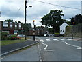
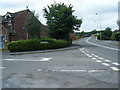
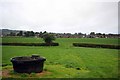
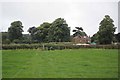
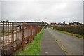
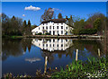
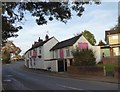
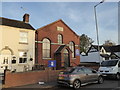
Madeley is a civil parish situated in Shropshire within the West Midlands region. The area spans 21.6 km² and forms part of the Telford new town. You will find the parish located approximately 1 mile north of a bend in the River Severn and 2 miles east by north of Ironbridge. Although the settlement was first mentioned in the Domesday Book of 1086, it now functions as a quiet residential community with a population of 2,457. The town centre retains historic significance, having evolved from an ancient market granted during the reign of Henry II. A market-house near Ironbridge remains a focal point today. All Saints Church stands as a prominent landmark; this building was rebuilt in 1796 in a Grecian style, replacing an original Norman structure. Local history includes notable figures such as vicar John Fletcher, who served between 1760 and 1785. While the past was driven by coal and ironstone mining, the present day offers a different pace of life. Living in Madeley provides access to local heritage without the congestion of larger urban centres. The parish environment blends ancient origins with modern residential needs.
- Area Type
- Parish
- Area Size
- 21.6 km²
- Population
- 2457
- Population Density
- 1406 people/km²
Demographics
The community profile of Madeley shows a distinct age distribution centred on older residents. The median age for the population is 70, making this the most common age demographic in the area. This statistic indicates that living in Madeley appeals primarily to retirees or those seeking a quieter lifestyle. Home ownership stands at 73%, which means the majority of households in the parish own their properties outright or with a mortgage. There is a minimal presence of private rental properties compared to the owner-occupied stock. You can expect a stable environment where residents have long-term ties to the local neighbourhood. The total household composition reflects this stability with high rates of ownership. Regarding ethnic diversity, the data indicates a total population figure without specific breakdowns of predominant groups, suggesting a homogeneous community makeup typical of many traditional English parishes. Religious affiliation is not specified in the available records for this parish. The demographic data paints a clear picture of an established, older community where stability is the norm.
Household Size
Accommodation Type
Tenure
Ethnic Group
Religion
Household Composition
Age
Household Deprivation
NS-SEC
Explore more demographic insights in this area
Go to Demographics tabPlanning
Planning Constraints
- Flood RiskPremium
- Ramsar Wetland SitesPremium
- Area of Outstanding Natural BeautyPremium
- Protected Nature ReservePremium
- Protected WoodlandPremium