Area Overview for Kingstone (East Staffordshire)
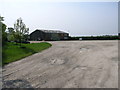
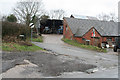
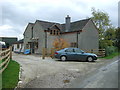
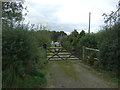
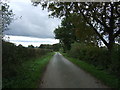
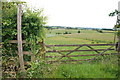
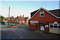
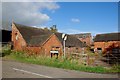
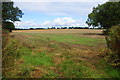
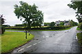
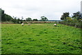
Photos of Kingstone (East Staffordshire)
Area Information
Living in Kingstone within East Staffordshire means settling into a compact built-up area defined by its managed scale. The settlement covers 27.8 hectares, creating a neighbourhood of contained density rather than sprawling suburban expansion. This specific size suggests a village-like community feel where the built environment is walkable and accessible. Residents of Kingstone benefit from a location that is distinct enough to offer local identity yet integrated into the wider East Staffordshire district. The area functions as a functional residential hub rather than a lifestyle centre for shopping or entertainment. You will find yourself in a setting that prioritises living space over commercial grandeur. The geography supports a quiet domestic life where access to nearby towns remains straightforward. Kingstone serves as the central residential anchor for those seeking a precise, low-mileage home in the county. The compact nature of the 27.8 hectares ensures that daily life requires minimal travel for local necessities. This is an environment suited to those who value established boundaries and a clear understanding of their immediate surroundings. The area represents a practical choice for homebuyers who prefer a defined community over an anonymous city fringe.
- Area Type
- Built Up Area 250
- Area Size
- 27.8 hectares
- Population
- Not available
- Population Density
- Not available
The lifestyle in Kingstone is facilitated by a cluster of nearby amenities within practical reach. Residents have access to five key retail outlets, providing essential shopping needs without requiring a long drive. Notable supermarkets include Asda Uttoxeter, Aldi Old Knotty Way, and Waitrose Uttoxeter. These specific venues cover most daily grocery and household shopping requirements. The presence of Waitrose suggests a level of provision that goes beyond basic convenience stores. For rail commuters, Uttoxeter Railway Station serves as the primary public transport node for the area. Living in Kingstone grants you access to these branded chains and transport hub within a short journey. Restaurants, parks, and leisure facilities are not detailed in the immediate data, so you must rely on the nearby town centres for cultural activities. The convenience factor is driven largely by the density of the retail options listed. You can expect to source groceries from the specific supermarkets named rather than visiting a generic high street. This mix of retail and rail defines the daily convenience of the area. The 27.8 hectares of residential space sit close enough to these services to maintain a balanced routine.
Amenities
Schools
Families considering property near Kingstone have access to education through specific nearby institutions. The closest facility is Talbot First School, which operates as an academy. This modern funding status often implies specific governance structures and inspection regimes different from traditional local authorities. You have one primary school option listed directly associated with the immediate vicinity of Kingstone. The fact that the school is recorded as both a standard primary institution and an academy highlights its dual operational identity. There are no secondary schools or universities listed in the immediate proximity of the area. This means that secondary education will likely require travel outside of Kingstone to a town further afield. The presence of a single primary academy suggests a focused educational cluster rather than a diverse range of school types. Parents planning to live in Kingstone must factor in transportation logistics for secondary school attendance, as the listed data contains no secondary institutions. The academy status of Talbot First School is a specific fact affecting your school choice calculations. Living in Kingstone places you within a short distance of this single primary provider.
| Rank | School | Type | Entry gender | Ages |
|---|
Explore more schools in this area
Go to Schools tabDemographics
The community profile of Kingstone reveals a resident base with a significant concentration of older adults. The median age of 70 indicates that the village is predominantly populated by retirees and the senior demographic. This age structure shapes the rhythm of daily life, with an emphasis on accessibility and established services. Across the borough, the total household composition reflects a community that is largely settled rather than expatriate. Home ownership stands at 83%, confirming that this is an area where most families and individuals have purchased their dwellings. This high purchase rate contrasts sharply with student villages or commuter zones dominated by tenancies. The accommodation types available are tailored to a long-term population rather than transient workers. While specific ethnicity and religion figures are absent from the current records, the dominance of older home owners points towards a longstanding local estate. The low median age also suggests limited new family formation or significant youth migration into the area. Living in Kingstone means joining a stationery of long-term residents who have likely lived in their properties for decades. The 83% ownership figure is a concrete marker of stability within the population.
Household Size
Accommodation Type
Tenure
Ethnic Group
Religion
Household Composition
Age
Household Deprivation
NS-SEC
Explore more demographic insights in this area
Go to Demographics tabPlanning
Planning Constraints
- Crime RiskPremium