Area Overview for Brereton and Ravenhill
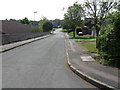
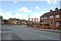
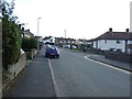
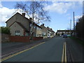
Photos of Brereton and Ravenhill

Area Information
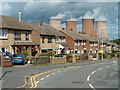
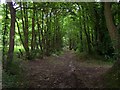
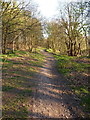
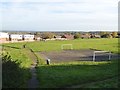
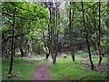
Brereton and Ravenhill represents a distinct district within the borough unitary ward of 5.3 square kilometres. You will find this area defined by a specific character that often appeals to those seeking a settled environment away from high-density urban living. The geographic size creates a contained community feel while still offering access to the wider region. This locality is particularly notable for its designation within an Area of Outstanding Natural Beauty, which imposes strict planning constraints on development. This status preserves the local landscape but also limits expansion if you consider building extensions or new properties. The combination of natural protection and rural setting shapes the daily rhythm here. Residents experience a slower pace compared to major city centres. While the area lacks major industrial hubs within its borders, the unique environmental designation provides peace and quiet. You should be aware that purchasing homes in Brereton and Ravenhill requires understanding these maintenance and planning restrictions. The safety profile supports a stable family environment with low crime rates. Connectivity remains strong despite the rural nature of the district. Digital infrastructure supports modern working life, ensuring you stay connected without city-centre delays.
- Area Type
- Parish
- Area Size
- 5.3 km²
- Population
- Not available
- Population Density
- Not available
Demographics
The community in Brereton and Ravenhill reflects an older demographic profile with a median age of 70 years. This statistic indicates that the area caters primarily to retirees rather than young professionals or growing families. Most households are composed entirely of adults, suggesting a settled population where long-term residents dominate the social fabric. Home ownership stands at 68 percent, meaning the majority of residents own their properties outright or with a mortgage. This high ownership rate contributes to stability within the neighbourhood. The household composition data shows that families with dependent children are not the primary demographic. Instead, you will encounter single occupants or couples living together. The accommodation mix reflects this age distribution, with larger homes suited to retirement needs often predominating. You do not find significant concentrations of private landlords renting out short-term stays. The ethnic and religious diversity data suggests a relatively homogenous population in terms of background. This demographic stability supports a quiet lifestyle without the frenetic energy found in student quarters or commuter estates.
Household Size
Accommodation Type
Tenure
Ethnic Group
Religion
Household Composition
Age
Household Deprivation
NS-SEC
Explore more demographic insights in this area
Go to Demographics tabPlanning
Planning Constraints
- Flood RiskPremium
- Ramsar Wetland SitesPremium
- Area of Outstanding Natural BeautyPremium
- Protected Nature ReservePremium
- Protected WoodlandPremium