Area Overview for ST9 0EG
Photos of ST9 0EG
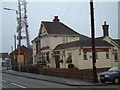
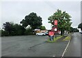
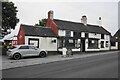
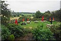
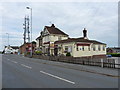
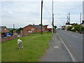
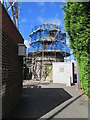
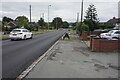

17 photos from this area
Area Information
Key information about the ST9 0EG including its size, population, and administrative classification.
- Area Type
- Postcode
- Area Size
- 1.6 hectares
- Population
- 1592
- Population Density
- 951 people/km²
House Prices in ST9 0EG
33
Properties
£161,889
Average Sold Price
£58,000
Lowest Price
£250,000
Highest Price
Showing 33 properties
| Address | Type | Beds | Baths | Last Sale Price | Last Sale Date | |
|---|---|---|---|---|---|---|
| 71 Armshead Road, Werrington, ST9 0EG | house | - | - | £200,000 | Mar 2025 | |
| 47 Armshead Road, Werrington, ST9 0EG | Semi-detached | 3 | 1 | £250,000 | Feb 2024 | |
| 45 Armshead Road, Werrington, ST9 0EG | Semi-detached | 3 | 1 | £195,000 | Dec 2022 | |
| Croft Cottage, 63 Armshead Road, Werrington, ST9 0EG | Semi-detached | 2 | 1 | £186,000 | Jun 2021 | |
| 99 Armshead Road, Werrington, ST9 0EG | Semi-detached | 3 | 1 | £180,000 | Jun 2019 | |
| 53 Armshead Road, Werrington, ST9 0EG | Semi-detached | 3 | 1 | £155,000 | Oct 2017 | |
| 79 Armshead Road, Werrington, ST9 0EG | Detached | 3 | 1 | £175,000 | Mar 2016 | |
| 37 Armshead Road, Werrington, ST9 0EG | Detached | 3 | 2 | £217,000 | Dec 2014 | |
| 101 Armshead Road, Werrington, ST9 0EG | house | 5 | - | £185,000 | Oct 2012 | |
| 75 Armshead Road, Werrington, ST9 0EG | Bungalow | - | - | £136,000 | Jul 2010 |
Page 1 of 4
Energy Efficiency in ST9 0EG
Amenities
Schools
| Rank | School | Type | Entry gender | Ages |
|---|
Explore more schools in this area
Go to Schools tabDemographics
Household Size
Two person
most common
Accommodation Type
Houses
most common
Tenure
92
majority
Ethnic Group
White
most common
Religion
N/A
most common
Household Composition
N/A
most common
Age
47
median
Adults (30-64 years)
most common
Household Deprivation
N/A
with no deprivation
NS-SEC
34
in Lower managerial occupations
Explore more demographic insights in this area
Go to Demographics tabPlanning
Planning Constraints
- Flood RiskPremium
- Ramsar Wetland SitesPremium
- Area of Outstanding Natural BeautyPremium
- Protected Nature ReservePremium
- Protected WoodlandPremium