Area Overview for ST5 3RY
Photos of ST5 3RY
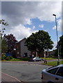
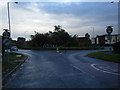
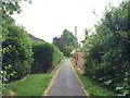
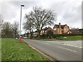
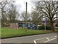

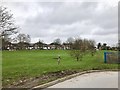

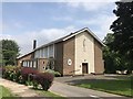
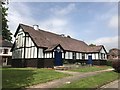

25 photos from this area
Area Information
Key information about the ST5 3RY including its size, population, and administrative classification.
- Area Type
- Postcode
- Area Size
- 5178 m²
- Population
- 1436
- Population Density
- 3687 people/km²
House Prices in ST5 3RY
11
Properties
£201,383
Average Sold Price
£76,000
Lowest Price
£320,000
Highest Price
Showing 11 properties
| Address | Type | Beds | Baths | Last Sale Price | Last Sale Date | |
|---|---|---|---|---|---|---|
| 29 The Plaisaunce, Newcastle Under Lyme, ST5 3RY | Detached | 4 | 1 | £320,000 | Jul 2022 | |
| 24 The Plaisaunce, Newcastle Under Lyme, ST5 3RY | Semi-detached | 3 | 1 | £275,000 | Mar 2019 | |
| 31 The Plaisaunce, Newcastle Under Lyme, ST5 3RY | Semi-detached | 3 | 1 | £294,950 | Aug 2018 | |
| 19 The Plaisaunce, Newcastle Under Lyme, ST5 3RY | Detached | 4 | 1 | £188,500 | Dec 2013 | |
| 26 The Plaisaunce, Newcastle Under Lyme, ST5 3RY | house | - | - | £185,000 | Dec 2012 | |
| 27 The Plaisaunce, Newcastle Under Lyme, ST5 3RY | Semi-detached | 3 | - | £208,000 | Oct 2007 | |
| 23 The Plaisaunce, Newcastle Under Lyme, ST5 3RY | Semi-detached | - | - | £175,000 | Jul 2004 | |
| 25 The Plaisaunce, Newcastle Under Lyme, ST5 3RY | Semi-detached | 3 | 1 | £76,000 | Dec 2000 | |
| 22 The Plaisaunce, Newcastle Under Lyme, ST5 3RY | Semi-detached | - | - | £90,000 | Nov 1999 | |
| 20 The Plaisaunce, Newcastle Under Lyme, ST5 3RY | Semi-detached | - | - | - | - |
Page 1 of 2
Energy Efficiency in ST5 3RY
Amenities
Schools
| Rank | School | Type | Entry gender | Ages |
|---|
Explore more schools in this area
Go to Schools tabDemographics
Household Size
One person
most common
Accommodation Type
Houses
most common
Tenure
68
majority
Ethnic Group
White
most common
Religion
N/A
most common
Household Composition
N/A
most common
Age
47
median
Adults (30-64 years)
most common
Household Deprivation
N/A
with no deprivation
NS-SEC
32
in Lower managerial occupations
Explore more demographic insights in this area
Go to Demographics tabPlanning
Planning Constraints
- Flood RiskPremium
- Ramsar Wetland SitesPremium
- Area of Outstanding Natural BeautyPremium
- Protected Nature ReservePremium
- Protected WoodlandPremium