Area Overview for ST5 2HB
Photos of ST5 2HB
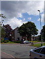
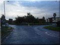
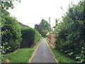
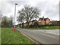

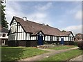

25 photos from this area
Area Information
Key information about the ST5 2HB including its size, population, and administrative classification.
- Area Type
- Postcode
- Area Size
- 1.1 hectares
- Population
- 1352
- Population Density
- 2405 people/km²
House Prices in ST5 2HB
17
Properties
£223,851
Average Sold Price
£86,000
Lowest Price
£493,215
Highest Price
Showing 17 properties
| Address | Type | Beds | Baths | Last Sale Price | Last Sale Date | |
|---|---|---|---|---|---|---|
| 1 Edward Avenue, Newcastle Under Lyme, ST5 2HB | Detached | 6 | 3 | £493,215 | May 2023 | |
| 3 Edward Avenue, Newcastle Under Lyme, ST5 2HB | house | - | - | £272,500 | Dec 2020 | |
| 10 Edward Avenue, Newcastle Under Lyme, ST5 2HB | Semi-detached | 3 | 1 | £222,000 | Jul 2020 | |
| 9 Edward Avenue, Newcastle Under Lyme, ST5 2HB | Detached | 4 | 2 | £320,000 | Nov 2014 | |
| 6 Edward Avenue, Newcastle Under Lyme, ST5 2HB | Detached | - | - | £303,500 | May 2010 | |
| 8 Edward Avenue, Newcastle Under Lyme, ST5 2HB | house | - | - | £170,000 | May 2009 | |
| 2 Edward Avenue, Newcastle Under Lyme, ST5 2HB | house | - | - | £280,000 | May 2008 | |
| 13 Edward Avenue, Newcastle Under Lyme, ST5 2HB | Semi-detached | - | - | £181,000 | May 2003 | |
| 18 Edward Avenue, Newcastle Under Lyme, ST5 2HB | Semi-detached | - | - | £112,000 | Mar 2000 | |
| 15 Edward Avenue, Newcastle Under Lyme, ST5 2HB | Detached | - | - | £157,000 | Dec 1999 |
Page 1 of 2
Energy Efficiency in ST5 2HB
Amenities
Schools
| Rank | School | Type | Entry gender | Ages |
|---|
Explore more schools in this area
Go to Schools tabDemographics
Household Size
Family (3-5 people)
most common
Accommodation Type
Houses
most common
Tenure
85
majority
Ethnic Group
White
most common
Religion
N/A
most common
Household Composition
N/A
most common
Age
47
median
Adults (30-64 years)
most common
Household Deprivation
N/A
with no deprivation
NS-SEC
47
in Lower managerial occupations
Explore more demographic insights in this area
Go to Demographics tabPlanning
Planning Constraints
- Flood RiskPremium
- Ramsar Wetland SitesPremium
- Area of Outstanding Natural BeautyPremium
- Protected Nature ReservePremium
- Protected WoodlandPremium