Area Overview for ST3 7XA
Photos of ST3 7XA
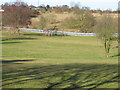
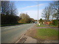
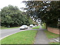
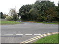
5 photos from this area
Area Information
Key information about the ST3 7XA including its size, population, and administrative classification.
- Area Type
- Postcode
- Area Size
- 3.4 hectares
- Population
- 1231
- Population Density
- 3967 people/km²
House Prices in ST3 7XA
20
Properties
£238,346
Average Sold Price
£95,000
Lowest Price
£499,995
Highest Price
Showing 20 properties
| Address | Type | Beds | Baths | Last Sale Price | Last Sale Date | |
|---|---|---|---|---|---|---|
| 17 Oakhurst Crescent, Meir, Stoke On Trent, ST3 7XA | Bungalow | 3 | 2 | £410,000 | Sep 2025 | |
| 4 Oakhurst Crescent, Meir, Stoke On Trent, ST3 7XA | Detached | 4 | 2 | £499,995 | Jun 2023 | |
| 5 Oakhurst Crescent, Meir, Stoke On Trent, ST3 7XA | house | - | - | £303,000 | Sep 2013 | |
| 29 Oakhurst Crescent, Meir, Stoke On Trent, ST3 7XA | Bungalow | - | - | £249,999 | Jul 2011 | |
| 1 Oakhurst Crescent, Meir, Stoke On Trent, ST3 7XA | house | - | - | £290,000 | Aug 2008 | |
| 10 Oakhurst Crescent, Meir, Stoke On Trent, ST3 7XA | Detached | - | - | £335,000 | Aug 2006 | |
| 14 Oakhurst Crescent, Meir, Stoke On Trent, ST3 7XA | Detached | 4 | 3 | £283,000 | Jun 2006 | |
| 6 Oakhurst Crescent, Meir, Stoke On Trent, ST3 7XA | house | - | - | £145,500 | Feb 2000 | |
| 18 Oakhurst Crescent, Meir, Stoke On Trent, ST3 7XA | Detached | - | - | £160,000 | Dec 1999 | |
| 31 Oakhurst Crescent, Meir, Stoke On Trent, ST3 7XA | Detached | - | - | £120,000 | Jul 1997 |
Page 1 of 2
Energy Efficiency in ST3 7XA
Amenities
Schools
| Rank | School | Type | Entry gender | Ages |
|---|
Explore more schools in this area
Go to Schools tabDemographics
Household Size
Family (3-5 people)
most common
Accommodation Type
Houses
most common
Tenure
87
majority
Ethnic Group
White
most common
Religion
N/A
most common
Household Composition
N/A
most common
Age
47
median
Adults (30-64 years)
most common
Household Deprivation
N/A
with no deprivation
NS-SEC
40
in Lower managerial occupations
Explore more demographic insights in this area
Go to Demographics tabPlanning
Planning Constraints
- Flood RiskPremium
- Ramsar Wetland SitesPremium
- Area of Outstanding Natural BeautyPremium
- Protected Nature ReservePremium
- Protected WoodlandPremium