Area Overview for ST3 7FU
Photos of ST3 7FU
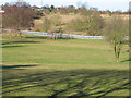
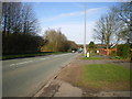
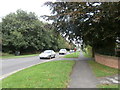
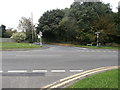
5 photos from this area
Area Information
Key information about the ST3 7FU including its size, population, and administrative classification.
- Area Type
- Postcode
- Area Size
- 1.3 hectares
- Population
- 1231
- Population Density
- 3967 people/km²
House Prices in ST3 7FU
40
Properties
£147,097
Average Sold Price
£39,250
Lowest Price
£290,000
Highest Price
Showing 40 properties
| Address | Type | Beds | Baths | Last Sale Price | Last Sale Date | |
|---|---|---|---|---|---|---|
| 103 Falcon Road, Meir Park, Stoke On Trent, ST3 7FU | house | - | - | £228,000 | Aug 2025 | |
| 85 Falcon Road, Meir Park, Stoke On Trent, ST3 7FU | Terraced | 3 | 1 | £160,000 | Jul 2025 | |
| 117 Falcon Road, Meir Park, Stoke On Trent, ST3 7FU | Semi-detached | 2 | 1 | £150,000 | Oct 2024 | |
| 78 Falcon Road, Meir Park, Stoke On Trent, ST3 7FU | Retail | 3 | 1 | £218,000 | Sep 2022 | |
| 84 Falcon Road, Meir Park, Stoke On Trent, ST3 7FU | Detached | 3 | 1 | £285,000 | Aug 2022 | |
| 109 Falcon Road, Meir Park, Stoke On Trent, ST3 7FU | Terraced | 2 | 1 | £138,000 | Jul 2022 | |
| 91 Falcon Road, Meir Park, Stoke On Trent, ST3 7FU | Semi-detached | 2 | 1 | £135,000 | May 2022 | |
| 86 Falcon Road, Meir Park, Stoke On Trent, ST3 7FU | house | - | - | £240,000 | Dec 2021 | |
| 90 Falcon Road, Meir Park, Stoke On Trent, ST3 7FU | house | - | - | £290,000 | Mar 2021 | |
| 97 Falcon Road, Meir Park, Stoke On Trent, ST3 7FU | Semi-detached | 2 | 1 | £117,000 | Mar 2021 |
Page 1 of 4
Energy Efficiency in ST3 7FU
Amenities
Schools
| Rank | School | Type | Entry gender | Ages |
|---|
Explore more schools in this area
Go to Schools tabDemographics
Household Size
Family (3-5 people)
most common
Accommodation Type
Houses
most common
Tenure
87
majority
Ethnic Group
White
most common
Religion
N/A
most common
Household Composition
N/A
most common
Age
47
median
Adults (30-64 years)
most common
Household Deprivation
N/A
with no deprivation
NS-SEC
40
in Lower managerial occupations
Explore more demographic insights in this area
Go to Demographics tabPlanning
Planning Constraints
- Flood RiskPremium
- Ramsar Wetland SitesPremium
- Area of Outstanding Natural BeautyPremium
- Protected Nature ReservePremium
- Protected WoodlandPremium