Area Overview for ST2 9EZ
Photos of ST2 9EZ
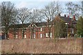
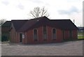
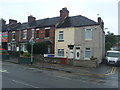
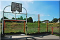
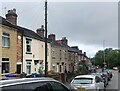
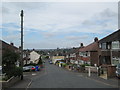
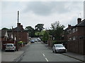
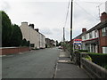
17 photos from this area
Area Information
Key information about the ST2 9EZ including its size, population, and administrative classification.
- Area Type
- Postcode
- Area Size
- 1.4 hectares
- Population
- 1650
- Population Density
- 4330 people/km²
House Prices in ST2 9EZ
46
Properties
£69,358
Average Sold Price
£16,100
Lowest Price
£116,500
Highest Price
Showing 46 properties
| Address | Type | Beds | Baths | Last Sale Price | Last Sale Date | |
|---|---|---|---|---|---|---|
| 33 Langford Road, Bucknall, Stoke On Trent, ST2 9EZ | house | - | - | £103,000 | Aug 2025 | |
| 75 Langford Road, Bucknall, Stoke On Trent, ST2 9EZ | Terraced | 3 | 1 | £72,200 | Aug 2019 | |
| 9 Langford Road, Bucknall, Stoke On Trent, ST2 9EZ | Terraced | 3 | 1 | £71,500 | Mar 2019 | |
| 67 Langford Road, Bucknall, Stoke On Trent, ST2 9EZ | Semi-detached | 3 | 1 | £72,000 | Jul 2018 | |
| 55 Langford Road, Bucknall, Stoke On Trent, ST2 9EZ | Semi-detached | 3 | 1 | £116,500 | Jun 2018 | |
| 17 Langford Road, Bucknall, Stoke On Trent, ST2 9EZ | Semi-detached | 3 | 1 | £94,500 | Jan 2017 | |
| 45 Langford Road, Bucknall, Stoke On Trent, ST2 9EZ | house | - | - | £72,500 | Mar 2014 | |
| 73 Langford Road, Bucknall, Stoke On Trent, ST2 9EZ | house | 2 | - | £52,500 | Oct 2013 | |
| 59 Langford Road, Bucknall, Stoke On Trent, ST2 9EZ | house | - | - | £75,000 | Jun 2006 | |
| 23 Langford Road, Bucknall, Stoke On Trent, ST2 9EZ | house | - | - | £60,000 | Jun 2005 |
Page 1 of 5
Energy Efficiency in ST2 9EZ
Amenities
Schools
| Rank | School | Type | Entry gender | Ages |
|---|
Explore more schools in this area
Go to Schools tabDemographics
Household Size
Family (3-5 people)
most common
Accommodation Type
Houses
most common
Tenure
38
majority
Ethnic Group
White
most common
Religion
N/A
most common
Household Composition
N/A
most common
Age
47
median
Adults (30-64 years)
most common
Household Deprivation
N/A
with no deprivation
NS-SEC
11
in Lower managerial occupations
Explore more demographic insights in this area
Go to Demographics tabPlanning
Planning Constraints
- Flood RiskPremium
- Ramsar Wetland SitesPremium
- Area of Outstanding Natural BeautyPremium
- Protected Nature ReservePremium
- Protected WoodlandPremium