Area Overview for ST2 9EP
Photos of ST2 9EP
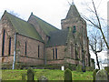
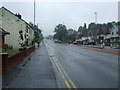
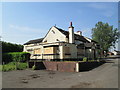
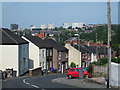
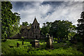
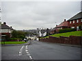
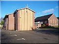
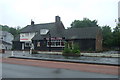
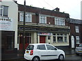
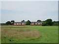
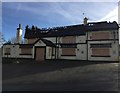
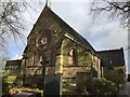
18 photos from this area
Area Information
Key information about the ST2 9EP including its size, population, and administrative classification.
- Area Type
- Postcode
- Area Size
- 7942 m²
- Population
- 1650
- Population Density
- 4330 people/km²
House Prices in ST2 9EP
30
Properties
£62,157
Average Sold Price
£16,500
Lowest Price
£115,000
Highest Price
Showing 30 properties
| Address | Type | Beds | Baths | Last Sale Price | Last Sale Date | |
|---|---|---|---|---|---|---|
| 96 Corneville Road, Bucknall, Stoke On Trent, ST2 9EP | Semi-detached | 3 | 1 | £115,000 | Dec 2018 | |
| 86 Corneville Road, Bucknall, Stoke On Trent, ST2 9EP | Semi-detached | 3 | - | £71,000 | Jul 2015 | |
| 60 Corneville Road, Bucknall, Stoke On Trent, ST2 9EP | Semi-detached | 3 | 1 | £71,000 | Oct 2014 | |
| 94 Corneville Road, Bucknall, Stoke On Trent, ST2 9EP | Semi-detached | 3 | 1 | £52,000 | Aug 2013 | |
| 90 Corneville Road, Bucknall, Stoke On Trent, ST2 9EP | house | - | - | £34,650 | May 2007 | |
| 70 Corneville Road, Bucknall, Stoke On Trent, ST2 9EP | Terraced | 3 | - | £74,950 | Jan 2006 | |
| 74 Corneville Road, Bucknall, Stoke On Trent, ST2 9EP | house | - | - | £16,500 | Jul 1997 | |
| 40 Corneville Road, Bucknall, Stoke On Trent, ST2 9EP | Semi-detached | 3 | 1 | - | - | |
| 54 Corneville Road, Bucknall, Stoke On Trent, ST2 9EP | house | - | - | - | - | |
| 88 Corneville Road, Bucknall, Stoke On Trent, ST2 9EP | Terraced | - | - | - | - |
Page 1 of 3
Energy Efficiency in ST2 9EP
Amenities
Schools
| Rank | School | Type | Entry gender | Ages |
|---|
Explore more schools in this area
Go to Schools tabDemographics
Household Size
Family (3-5 people)
most common
Accommodation Type
Houses
most common
Tenure
38
majority
Ethnic Group
White
most common
Religion
N/A
most common
Household Composition
N/A
most common
Age
47
median
Adults (30-64 years)
most common
Household Deprivation
N/A
with no deprivation
NS-SEC
11
in Lower managerial occupations
Explore more demographic insights in this area
Go to Demographics tabPlanning
Planning Constraints
- Flood RiskPremium
- Ramsar Wetland SitesPremium
- Area of Outstanding Natural BeautyPremium
- Protected Nature ReservePremium
- Protected WoodlandPremium