Area Overview for ST17 0RJ
Photos of ST17 0RJ
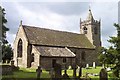
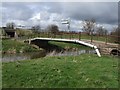
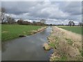
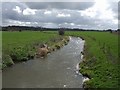
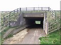
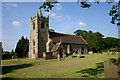
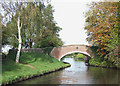
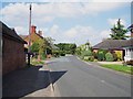
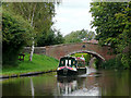
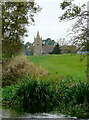
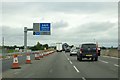
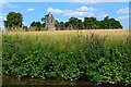
100 photos from this area
Area Information
Key information about the ST17 0RJ including its size, population, and administrative classification.
- Area Type
- Postcode
- Area Size
- 15.4 hectares
- Population
- 1781
- Population Density
- 57 people/km²
House Prices in ST17 0RJ
59
Properties
£301,976
Average Sold Price
£86,000
Lowest Price
£835,000
Highest Price
Showing 59 properties
| Address | Type | Beds | Baths | Last Sale Price | Last Sale Date | |
|---|---|---|---|---|---|---|
| Heather Cottage, Lower Penkridge Road, Acton Trussell, ST17 0RJ | Detached | 3 | 2 | £385,000 | Mar 2025 | |
| Aston House, Lower Penkridge Road, Acton Trussell, ST17 0RJ | Bungalow | 3 | 2 | £835,000 | May 2024 | |
| Pixies Way, Lower Penkridge Road, Acton Trussell, ST17 0RJ | Bungalow | - | - | £635,000 | Mar 2022 | |
| The Oaks, Lower Penkridge Road, Acton Trussell, ST17 0RJ | Detached | 3 | 2 | £460,000 | Jan 2022 | |
| The Mount, Lower Penkridge Road, Acton Trussell, ST17 0RJ | Semi-detached | 3 | 2 | £280,000 | Mar 2019 | |
| Acton Close, Lower Penkridge Road, Acton Trussell, ST17 0RJ | Bungalow | 4 | 2 | £425,000 | Feb 2019 | |
| Fairlawns, Lower Penkridge Road, Acton Trussell, ST17 0RJ | Detached | 3 | 1 | £280,000 | Jan 2019 | |
| Doe Bank, Lower Penkridge Road, Acton Trussell, ST17 0RJ | Bungalow | 2 | 1 | £240,000 | Dec 2018 | |
| Holly Cottage, Lower Penkridge Road, Acton Trussell, ST17 0RJ | Detached | - | - | £445,000 | Jun 2018 | |
| 8 Lower Penkridge Road, Acton Trussell, ST17 0RJ | Detached | 4 | 2 | £300,000 | Feb 2018 |
Page 1 of 6
Energy Efficiency in ST17 0RJ
Amenities
Schools
| Rank | School | Type | Entry gender | Ages |
|---|
Explore more schools in this area
Go to Schools tabDemographics
Household Size
Two person
most common
Accommodation Type
Houses
most common
Tenure
81
majority
Ethnic Group
White
most common
Religion
N/A
most common
Household Composition
N/A
most common
Age
47
median
Adults (30-64 years)
most common
Household Deprivation
N/A
with no deprivation
NS-SEC
47
in Lower managerial occupations
Explore more demographic insights in this area
Go to Demographics tabPlanning
Planning Constraints
- Flood RiskPremium
- Ramsar Wetland SitesPremium
- Area of Outstanding Natural BeautyPremium
- Protected Nature ReservePremium
- Protected WoodlandPremium