Area Overview for ST15 8UX
Photos of ST15 8UX
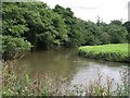
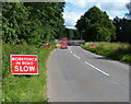
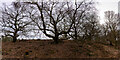

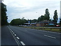
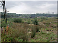
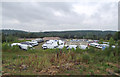
7 photos from this area
Area Information
Key information about the ST15 8UX including its size, population, and administrative classification.
- Area Type
- Postcode
- Area Size
- 43.1 hectares
- Population
- 1239
- Population Density
- 48 people/km²
House Prices in ST15 8UX
15
Properties
£131,825
Average Sold Price
£114,500
Lowest Price
£149,150
Highest Price
Showing 15 properties
| Address | Type | Beds | Baths | Last Sale Price | Last Sale Date | |
|---|---|---|---|---|---|---|
| Saumarez, Meaford Road, Meaford, Stone, ST15 8UX | Detached | - | - | £149,150 | Aug 1998 | |
| Home Farm Cottage, Meaford Road, Meaford, Stone, ST15 8UX | Semi-detached | - | - | £114,500 | Sep 1996 | |
| Collingwood, Admirals View, Meaford Road, Meaford, Stone, ST15 8UX | Detached | 4 | 3 | - | - | |
| Nelson, Admirals View, Meaford Road, Meaford, Stone, ST15 8UX | Detached | 4 | 3 | - | - | |
| DOMESTIC PREMISES AT, LAKESIDE TAVERN, MEAFORD ROAD, Meaford, Stone, ST15 8UX | Detached | - | - | - | - | |
| Domestic Premises At Lakeside Tavern, Meaford Road, Meaford, Stone, ST15 8UX | undefined | - | - | - | - | |
| Poultry Sheds, Meaford Road, Meaford, Stone, ST15 8UX | Detached | - | - | - | - | |
| Home Farm, Meaford Road, Meaford, Stone, ST15 8UX | Semi-detached | - | - | - | - | |
| The Lakeside Tavern Zaminsky, Meaford Road, Meaford, Stone, ST15 8UX | Mobile Home | - | - | - | - | |
| The Lakeside Tavern, Meaford Road, Meaford, Stone, ST15 8UX | restaurant_cafe | - | - | - | - |
Page 1 of 2
Energy Efficiency in ST15 8UX
Amenities
Schools
| Rank | School | Type | Entry gender | Ages |
|---|
Explore more schools in this area
Go to Schools tabDemographics
Household Size
Two person
most common
Accommodation Type
Houses
most common
Tenure
80
majority
Ethnic Group
White
most common
Religion
N/A
most common
Household Composition
N/A
most common
Age
47
median
Adults (30-64 years)
most common
Household Deprivation
N/A
with no deprivation
NS-SEC
42
in Lower managerial occupations
Explore more demographic insights in this area
Go to Demographics tabPlanning
Planning Constraints
- Flood RiskPremium
- Ramsar Wetland SitesPremium
- Area of Outstanding Natural BeautyPremium
- Protected Nature ReservePremium
- Protected WoodlandPremium