Area Overview for ST15 8GW
Photos of ST15 8GW
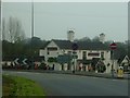
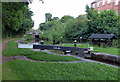
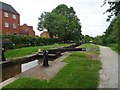
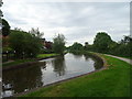
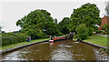
![Bywash, Meaford Bottom Lock [no 31] in ST15 8GW](https://images.propbar.co.uk/images/geograph/66/53/6653095_120.jpg)
32 photos from this area
Area Information
Key information about the ST15 8GW including its size, population, and administrative classification.
- Area Type
- Postcode
- Area Size
- 5355 m²
- Population
- 1239
- Population Density
- 48 people/km²
House Prices in ST15 8GW
9
Properties
£179,678
Average Sold Price
£500
Lowest Price
£340,000
Highest Price
Showing 9 properties
| Address | Type | Beds | Baths | Last Sale Price | Last Sale Date | |
|---|---|---|---|---|---|---|
| 7, St Vincent Mews, Meaford Road, Meaford, Stone, ST15 8GW | Terraced | 3 | 2 | £340,000 | Oct 2023 | |
| 9, St Vincent Mews, Meaford Road, Meaford, Stone, ST15 8GW | Terraced | 2 | 1 | £295,000 | Jul 2023 | |
| 5, St Vincent Mews, Meaford Road, Meaford, Stone, ST15 8GW | Terraced | 3 | 1 | £242,000 | Apr 2023 | |
| 3, St Vincent Mews, Meaford Road, Meaford, Stone, ST15 8GW | Semi-detached | 2 | 2 | £165,000 | Jan 2023 | |
| 6, St Vincent Mews, Meaford Road, Meaford, Stone, ST15 8GW | Terraced | 3 | 2 | £180,000 | Jul 2020 | |
| 1, St Vincent Mews, Meaford Road, Meaford, Stone, ST15 8GW | Terraced | 3 | 2 | £500 | Dec 2019 | |
| 2, St Vincent Mews, Meaford Road, Meaford, Stone, ST15 8GW | Terraced | 3 | 3 | £500 | Dec 2019 | |
| 8, St Vincent Mews, Meaford Road, Meaford, Stone, ST15 8GW | Terraced | 3 | 2 | £249,099 | Apr 2009 | |
| 4, St Vincent Mews, Meaford Road, Meaford, Stone, ST15 8GW | Terraced | 1 | - | £145,000 | Dec 2006 |
Energy Efficiency in ST15 8GW
Amenities
Schools
| Rank | School | Type | Entry gender | Ages |
|---|
Explore more schools in this area
Go to Schools tabDemographics
Household Size
Two person
most common
Accommodation Type
Houses
most common
Tenure
80
majority
Ethnic Group
White
most common
Religion
N/A
most common
Household Composition
N/A
most common
Age
47
median
Adults (30-64 years)
most common
Household Deprivation
N/A
with no deprivation
NS-SEC
42
in Lower managerial occupations
Explore more demographic insights in this area
Go to Demographics tabPlanning
Planning Constraints
- Flood RiskPremium
- Ramsar Wetland SitesPremium
- Area of Outstanding Natural BeautyPremium
- Protected Nature ReservePremium
- Protected WoodlandPremium