Area Overview for ST15 8UL
Photos of ST15 8UL
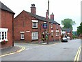
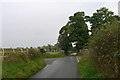
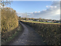
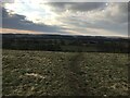
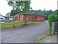
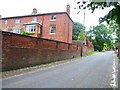
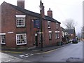
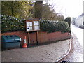
8 photos from this area
Area Information
Key information about the ST15 8UL including its size, population, and administrative classification.
- Area Type
- Postcode
- Area Size
- 1.3 hectares
- Population
- 1239
- Population Density
- 48 people/km²
House Prices in ST15 8UL
17
Properties
£272,591
Average Sold Price
£117,500
Lowest Price
£445,000
Highest Price
Showing 17 properties
| Address | Type | Beds | Baths | Last Sale Price | Last Sale Date | |
|---|---|---|---|---|---|---|
| 15 Church Lane, Oulton, Stone, ST15 8UL | Semi-detached | 4 | 1 | £349,000 | Jan 2023 | |
| 8 Church Lane, Oulton, Stone, ST15 8UL | Semi-detached | 3 | 2 | £250,000 | Oct 2022 | |
| 30 Church Lane, Oulton, Stone, ST15 8UL | Detached | 4 | 3 | £442,500 | Dec 2020 | |
| 28 Church Lane, Oulton, Stone, ST15 8UL | house | 4 | - | £250,000 | Dec 2011 | |
| 26 Church Lane, Oulton, Stone, ST15 8UL | Detached | 3 | 2 | £237,500 | Jan 2008 | |
| 12 Church Lane, Oulton, Stone, ST15 8UL | Terraced | - | - | £205,000 | Oct 2007 | |
| Peelers Cottage, 7 Church Lane, Oulton, Stone, ST15 8UL | Detached | - | - | £445,000 | Jul 2007 | |
| 11 Church Lane, Oulton, Stone, ST15 8UL | Bungalow | - | - | £212,000 | Dec 2006 | |
| Abbey Croft, 13 Church Lane, Oulton, Stone, ST15 8UL | Detached | - | - | £250,000 | Jun 2006 | |
| Roulston House, 3 Church Lane, Oulton, Stone, ST15 8UL | Detached | - | - | £240,000 | Aug 2001 |
Page 1 of 2
Energy Efficiency in ST15 8UL
Amenities
Schools
| Rank | School | Type | Entry gender | Ages |
|---|
Explore more schools in this area
Go to Schools tabDemographics
Household Size
Two person
most common
Accommodation Type
Houses
most common
Tenure
80
majority
Ethnic Group
White
most common
Religion
N/A
most common
Household Composition
N/A
most common
Age
47
median
Adults (30-64 years)
most common
Household Deprivation
N/A
with no deprivation
NS-SEC
42
in Lower managerial occupations
Explore more demographic insights in this area
Go to Demographics tabPlanning
Planning Constraints
- Flood RiskPremium
- Ramsar Wetland SitesPremium
- Area of Outstanding Natural BeautyPremium
- Protected Nature ReservePremium
- Protected WoodlandPremium