Area Overview for ST15 8UJ
Photos of ST15 8UJ
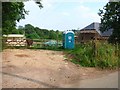
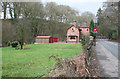
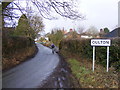
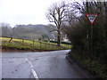

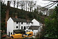
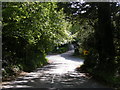
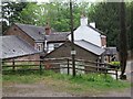
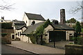
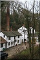

14 photos from this area
Area Information
Key information about the ST15 8UJ including its size, population, and administrative classification.
- Area Type
- Postcode
- Area Size
- 33.9 hectares
- Population
- 1239
- Population Density
- 48 people/km²
House Prices in ST15 8UJ
42
Properties
£227,565
Average Sold Price
£81,150
Lowest Price
£500,000
Highest Price
Showing 42 properties
| Address | Type | Beds | Baths | Last Sale Price | Last Sale Date | |
|---|---|---|---|---|---|---|
| 34 Kibblestone Road, Oulton, Stone, ST15 8UJ | Bungalow | 3 | 3 | £500,000 | Oct 2022 | |
| 28 Kibblestone Road, Oulton, Stone, ST15 8UJ | Bungalow | 2 | - | £360,000 | Jan 2021 | |
| 26 Kibblestone Road, Oulton, Stone, ST15 8UJ | Detached | 4 | 1 | £267,000 | Nov 2015 | |
| 23 Kibblestone Road, Oulton, Stone, ST15 8UJ | house | - | - | £150,000 | Nov 2014 | |
| 11 Kibblestone Road, Oulton, Stone, ST15 8UJ | Terraced | 2 | 1 | £81,150 | Aug 2013 | |
| The Ridings, 22A Kibblestone Road, Oulton, Stone, ST15 8UJ | Detached | 3 | 1 | £249,999 | Jun 2013 | |
| 36 Kibblestone Road, Oulton, Stone, ST15 8UJ | Bungalow | 3 | 2 | £235,000 | Aug 2010 | |
| 9 Kibblestone Road, Oulton, Stone, ST15 8UJ | house | - | - | £82,500 | Sep 2007 | |
| 30 Kibblestone Road, Oulton, Stone, ST15 8UJ | Detached | 3 | 1 | £170,000 | Dec 2002 | |
| 40 Kibblestone Road, Oulton, Stone, ST15 8UJ | Bungalow | 5 | 2 | £180,000 | Feb 1995 |
Page 1 of 5
Energy Efficiency in ST15 8UJ
Amenities
Schools
| Rank | School | Type | Entry gender | Ages |
|---|
Explore more schools in this area
Go to Schools tabDemographics
Household Size
Two person
most common
Accommodation Type
Houses
most common
Tenure
80
majority
Ethnic Group
White
most common
Religion
N/A
most common
Household Composition
N/A
most common
Age
47
median
Adults (30-64 years)
most common
Household Deprivation
N/A
with no deprivation
NS-SEC
42
in Lower managerial occupations
Explore more demographic insights in this area
Go to Demographics tabPlanning
Planning Constraints
- Flood RiskPremium
- Ramsar Wetland SitesPremium
- Area of Outstanding Natural BeautyPremium
- Protected Nature ReservePremium
- Protected WoodlandPremium