Area Overview for ST15 0JR
Photos of ST15 0JR
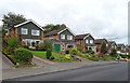
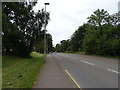
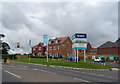
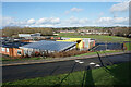
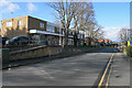
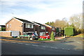
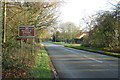
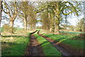
17 photos from this area
Area Information
Key information about the ST15 0JR including its size, population, and administrative classification.
- Area Type
- Postcode
- Area Size
- 1.0 hectares
- Population
- 1332
- Population Density
- 3732 people/km²
House Prices in ST15 0JR
20
Properties
£149,073
Average Sold Price
£60,000
Lowest Price
£215,000
Highest Price
Showing 20 properties
| Address | Type | Beds | Baths | Last Sale Price | Last Sale Date | |
|---|---|---|---|---|---|---|
| 18 Croft Road, Stone, ST15 0JR | Bungalow | 2 | 1 | £215,000 | Mar 2021 | |
| 3 Croft Road, Stone, ST15 0JR | Bungalow | 3 | 2 | £175,000 | Nov 2020 | |
| 16 Croft Road, Stone, ST15 0JR | Bungalow | 2 | 1 | £190,000 | Oct 2016 | |
| 6 Croft Road, Stone, ST15 0JR | Bungalow | - | - | £165,000 | Jan 2015 | |
| 24 Croft Road, Stone, ST15 0JR | Bungalow | 2 | - | £155,000 | Oct 2014 | |
| 11 Croft Road, Stone, ST15 0JR | Bungalow | 2 | 1 | £120,000 | Aug 2014 | |
| 13 Croft Road, Stone, ST15 0JR | Bungalow | 2 | - | £157,000 | Nov 2013 | |
| 1 Croft Road, Stone, ST15 0JR | Bungalow | - | - | £149,950 | Jul 2010 | |
| 20 Croft Road, Stone, ST15 0JR | Detached | - | - | £160,000 | Jul 2007 | |
| 10 Croft Road, Stone, ST15 0JR | Detached | - | - | £154,000 | Jun 2006 |
Page 1 of 2
Energy Efficiency in ST15 0JR
Amenities
Schools
| Rank | School | Type | Entry gender | Ages |
|---|
Explore more schools in this area
Go to Schools tabDemographics
Household Size
Two person
most common
Accommodation Type
Houses
most common
Tenure
90
majority
Ethnic Group
White
most common
Religion
N/A
most common
Household Composition
N/A
most common
Age
47
median
Adults (30-64 years)
most common
Household Deprivation
N/A
with no deprivation
NS-SEC
35
in Lower managerial occupations
Explore more demographic insights in this area
Go to Demographics tabPlanning
Planning Constraints
- Flood RiskPremium
- Ramsar Wetland SitesPremium
- Area of Outstanding Natural BeautyPremium
- Protected Nature ReservePremium
- Protected WoodlandPremium